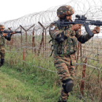
Tension in Syria: Rebels cannons reached the capital Damascus; President Assad fled the country

Tension in Syria: Rebels cannons reached the capital Damascus; President Assad fled the country

Syria

The situation in Syria has become very tense. Their army is weakening, and the fighters are capturing cities one after the other. Now, they have captured the major city of Homs and have moved towards the capital, Damascus. It is said that the rebel army has also captured Damascus. Rebel commanders have reached the capital with their cannons and equipment. Local citizens have claimed a fierce battle is going on for capture at many places. Gun firing is taking place in many places.

A news agency has claimed that Syrian President Bashar al-Assad has left for some unknown place in a special plane from the country. Meanwhile, there is an atmosphere of panic and mess at Damascus International Airport. Fearing the loss of power of President Bashar al-Assad, his supporters are struggling to flee from the country.

After capturing Hama, Aleppo, and Daraa, Homs is the fourth major city that has been captured by the rebels. Some videos that have emerged on social media tell the story of the capture of the city. A video has also emerged in which sounds of gunfire can be heard between Syrian rebels fighting with government forces for control of the major city of Homs and rebel fighters are seen on the streets.

Rebels celebrated by firing bullets

After the army exited from the central city, thousands of Homs citizens came out on the streets and celebrated by shouting slogans: “Assad is gone, Homs is free” and “Long live Syria, down with Bashar al-Assad.” The rebels celebrated by firing bullets in the air, while eager youths ripped off the posters of Syrian President Assad. According to a news agency, when opposition troopers reached the suburbs of Damascus, Bashar Assad, who was the president of the country for 24 years, was not traceable.

The rebels openly fired bullets on the streets of Homs and have so far captured four big cities. The capture of Homs is potentially the biggest disappointment for Assad. Now these rebels are moving towards the Syrian capital, Damascus.

ALSO READ: The president declared martial law in South Korea

Syria

The city of Homs, situated between Syria’s coastal provinces Latakia and Tartus, is a crucial city connecting Damascus to the Mediterranean coast, which is now under the control of the rebels. After capturing the city, its connection with the coastal areas of the capital has been cut off where people of Assad’s Alawite community live. There is another interesting thing: Russia operates its major naval base here.

Only three provincial capitals are under the control of the government


Activities of the rebels have increased around the capital Damascus. According to a news agency, after the Syrian army was removed from the southern part of the country, many areas, including provincial capitals, have now come under the control of the rebels. For the first time in the country’s long-running civil war, the government now has control over only three of the 14 provincial capitals, which include Damascus, Latakia, and Tartus.

Shortage of essential goods in the market


Damascus’s citizens have now started stocking essential food items. Thousands of people have gone to the Syrian border with Lebanon in an attempt to leave the country. One resident said that many shops in the capital city have closed, and those that are open have run out of essential items. Some shops are selling goods at very high prices. One individual said, “The situation is very strange. We are not used to this.” People fear that they may face revenge.

Removal of Assad is sure?

Protests took place in several outskirts of Damascus, with protesters removing symbols of Assad’s rule. Several witnesses said some soldiers took off their uniforms and joined the protesters. Rebel forces are now within 30 km of the capital Damascus, further risking the government’s hold on power. Foreign officers speaking on condition of obscurity said Assad’s government could fall within some days. A US official evaluated the time frame as 5-10 days, while another said the president could be overthrown from power within a week.

Syria

Summary

Syria is almost free from Assad’s control. The capital Damascus has been grabbed by rebels. The army has surrendered to the rebels. Syrian President Bashar al-Assad has fled the country. The Syrian Army Commander announced the end of the Assad government. Syrian rebels also declared on Sunday that the Syrian president has fled the capital. The rebels have declared Damascus free from Assad’s control. The rebels have taken over almost everything, from the police headquarters to the TV network. Rebels’ artillery and tanks are thundering on the streets of the capital Damascus.

विश्व भूगोल

विश्व भूगोल

विश्व

विश्व भूगोल: मिस्र, फोनीशियन और चीनी भौगोलिक समझ जैसी प्राचीन संस्कृतियाँ, लेकिन उनमें से कुछ ही अभिलेख बचे हैं, और इसलिए यूनानी आज के प्रारंभिक ज्ञान का मुख्य स्रोत बन गए हैं। होमर के महाकाव्य, द लियाड और द ओडिसी, नौवीं शताब्दी ईसा पूर्व में वापस आते हैं। वे यूनानियों को दुभाषियों, यात्रियों और दूर देशों के पर्यवेक्षकों के रूप में प्रकट करते हैं। वे वैज्ञानिक जांच में भी उत्कृष्ट थे।

15वीं, 16वीं और 17वीं शताब्दी में यूरोपीय और एशियाई दोनों खोजकर्ताओं द्वारा अन्वेषण के उत्कर्ष के दौरान भूभौतिकी ज्ञान तेजी से उन्नत हुआ। प्रत्येक यात्रा में मानचित्रण, सर्वेक्षण और मसाला एकत्र करना स्टॉक गतिविधियाँ बन गईं।

Read also: ब्रह्मांड

21वीं सदी में, कुछ कंप्यूटर क्लिक से पृथ्वी की सतह के अधिकांश भाग की तस्वीरें या मानचित्र संबंधी जानकारी प्राप्त की जा सकती है। हम मानचित्र पर मार्ग दर्शाने की आवश्यकता के बिना, लगभग कहीं भी जाने के लिए दिशा-निर्देश प्राप्त करने की क्षमता को मान लेते हैं।

आधुनिक विज्ञान और सूचना संग्रहण ने भूगोलवेत्ताओं को पहले से कहीं अधिक अंतर्दृष्टि प्रदान की है, और आधुनिक तकनीक इसे दुनिया भर में साझा करने की अनुमति देती है, लेकिन कई लोगों के लिए, तथ्यों और शब्दों में संदर्भ का अभाव है। भूगोल की समझ, भौतिक और सांस्कृतिक दोनों, उस संदर्भ को और अधिक आवश्यक और महत्वपूर्ण बनाती है। वैश्विक बातचीत और पृथ्वी के भविष्य के लिए जिम्मेदारी साझा करना हम सभी को जोड़ता है।

विश्व

टॉलेमी/प्राचीन भूगोलवेत्ता

ग्रीक वंश के मिस्र में जन्मे क्लॉडियस टॉलेमी (लगभग 90-168 ई.) ने कार्टोग्राफी, गणित और खगोल विज्ञान के ग्रीक-रोमन विश्व ज्ञान को संश्लेषित करने वाले कार्य का एक समूह बनाया। उनके आठवें खंड, भूगोल, ने विश्व मानचित्र और 26 क्षेत्रीय मानचित्रों सहित एक शब्द मानचित्र तैयार करने के लिए निर्देश और जानकारी प्रदान की।

उन्होंने कई मानचित्र प्रक्षेपण भी खोजे और लगभग 8,000 स्थानों के नाम और उनके निर्देशांक की एक सूची प्रदान की। अल्मागेस्ट, सौर मंडल के खगोल-भौगोलिक मॉडल पर उनका 13-खंड का ग्रंथ, और उनकी चार पुस्तकें ट्रट्राबिब्लोस ने ज्योतिष को अधिक वैज्ञानिक मामले के साथ समेटने की कोशिश की, जो इस्लामी विद्वानों द्वारा किए गए अरबी अनुवादों के माध्यम से फैला और पूर्वी और पश्चिमी भूगोल और कार्टोग्राफी विचारों को प्रभावित किया।

भूगोल का दायरा

आज विश्व भूगोल स्थान में निहित है, लेकिन इसमें मानचित्र पर स्थान के नामों की स्थिति से कहीं अधिक शामिल है; यह कई अलग-अलग विषयों के तरीकों और ज्ञान को एकीकृत करता है, और आय भौतिक और सामाजिक विज्ञान दोनों से होकर गुजरती है। यह निर्धारित करने के लिए इन सभी विषयों का उपयोग करता है। चीज़ें किसी विशेष स्थान पर या विशेष स्थानिक पैटर्न के अनुसार क्यों घटित होती हैं?

कॉर्पोरेट भूविज्ञान और जलवायु विज्ञान, जीव विज्ञान, पारिस्थितिकी, जल विज्ञान और अन्य प्राकृतिक विज्ञानों में भौतिक भूगोल। मानव विश्व भूगोल में समाजशास्त्र, अर्थशास्त्र, राजनीति विज्ञान, इतिहास, जनसांख्यिकी और अन्य सामाजिक विज्ञान शामिल हैं। कार्टोग्राफी, जो मानचित्र बनाने की कला और विज्ञान है, भौगोलिक सेटिंग्स का ग्राफिक प्रतिनिधित्व प्रदान करती है।

विश्व भूगोलवेत्ता अपने डेटा एकत्रीकरण, विश्लेषण और प्रतिनिधित्व में अन्य उपकरणों का भी उपयोग करते हैं, जिनमें सांख्यिकीय तस्वीरें, दूर से खींची गई छवियां जैसे उपग्रह तस्वीरें और कंप्यूटर-जनित ग्राफिक्स शामिल हैं।

विश्व

मानचित्रों में विश्व

सोचिए कि एक संतरे को छीलना और उसके छिलके के टुकड़ों को मेज पर दबाकर रखना कितना कठिन है। यह सादृश्य मानचित्र निर्माता के सामने आने वाली चुनौती का प्रतिनिधित्व करता है, जो गोलाकार ग्रह पृथ्वी को एक सपाट दृश्य प्रतिनिधित्व में बदलने का प्रयास करता है। किसी गोले की सतह को जीवंत बनाने की चुनौती से निपटने के लिए, सपाट मानचित्रकार उन आकृतियों का उपयोग करते हैं जो खुद को समतल करने में सक्षम होती हैं, जैसे योजनाएं और सिलेंडर जिन्हें विकास योग्य सतहों के रूप में जाना जाता है।

विकास योग्य सतहों पर गणितीय गणना लागू करके, वे पृथ्वी की विशेषताओं को सपाट रूपों में बदल सकते हैं। उन रूपों को प्रक्षेपण कहा जाता है और वे मानचित्र-निर्माण की चुनौती का प्रतिनिधित्व करते हैं।

सदियों से, प्रक्षेपण अनिवार्य रूप से होते रहे हैं और परिणामस्वरूप विकृतियाँ होती हैं। मानचित्र आकार की पसंद से उन विकृतियों को कुछ हद तक नियंत्रित किया जा सकता है, जो इस बात पर निर्भर करता है कि मानचित्रकार के माध्यम से ग्रह का कौन सा हिस्सा सबसे अधिक रुचि रखता है।

केवल वहीं मानचित्र पूरी तरह से सटीक होगा जहां सतह सीधे ग्लोब को छूती है। संपर्क के इन बिंदुओं से दूर, पृथ्वी की विशेषताएं सपाट होने के लिए खिंची हुई या सिकुड़ी हुई हो जाती हैं।

Read more: Geography

THE WORLD GEOGRAPHY

THE WORLD GEOGRAPHY

WORLD

Ancient cultures such as the Egyptian, Phoenician, and Chinese geographical understanding, but few of those records survive, and so the Greeks have become today’s main source of early knowledge. Homers epics, The Liad and the Odyssey, return in the ninth century BC. They reveal the Greeks as interpreters, travelers, and observers of distant lands. They also excelled in scientific inquiry.

Geophysics knowledge advanced exponentially during the heyday of exploration by both European and Asian explorers in the 15th, 16th, and 17th centuries. Mapping, surveying, and spice collecting became stock activities on every voyage.

Read also: ब्रह्मांड

In the 21st century, a few computer clicks can bring photos or map information to much of the earth’s surface. We take for granted the ability to get directions to almost anywhere we need to go, without needing to plot the course on a map.

Modern science and information gathering have given geographers more insight then ever before, and modern technology allows it to be shared world-wide, but for many people, facts and terms lack context. An understanding of geography, both physical and cultural, makes that context ever more necessary and important. Global interactions and sharing responsibility for the earth’s future connect us all.

WORLD

Ptolemy / ANCIENT GEOGRAPHER

Born in Egypt of a Greek family, Claudius Ptolemy (ca. A.D. 90–168) created a body of work synthesizing the Greco-Roman world knowledge of cartography, mathematics, and astronomy. His eighth volume, Geography, offered instructions and information for preparing a word map, including a world map and 26 regional maps. He also found a number of map projections and provided a list of some 8,000 place names and their coordinates. Almagest, his 13-volume treatise on the astronomy-geocentric model of the solar system, and his four books, Tetrabiblos, tried to Reconcile astrology with more scientific matter Spread through Arabic translations made by Islamic scholars and influenced near eastern and western geography and cartography thoughts for centuries.

THE SCOPE OF GEOGRAPHY

Today, the world is rooted in location, but it involves more than just the position of place names on a map; it integrates methods and knowledge from many different disciplines, and income passes through both the physical and social sciences. It uses all these disciplines to determine why things occur in a specific area or as per specific spatial examples?.

Physical geography in corporate geology and climatology, biology, ecology, hydrology, and other natural sciences. Human geography includes sociology, economics, political science, history, demography, and other social sciences. Cartography, which is the art and science of making maps, provides graphic representations of geographic settings.

The World Geographers also use other tools in their data gathering, analysis, and representation, including statistical photographs, remotely captured images such as satellite photos, and computer-generated graphics.

WORLD

THE WORLD IN MAPS

Think of how hard it is to peel an orange and press the resulting pieces of peel down flat on a table. That analogy represents the challenge faced by the map maker, who attempt to turn the spherical planet earth into a flat visual representation. To handle the test of getting the outer layer of a circle to life, level map makers use shapes that lend themselves to straightening, for example, plans and chambers known as developable surfaces.

By applying numerical estimations to the developable surfaces, they can change earth highlights into level structures. Those forms are called projections and represent the challenge of map-making.

Through the centuries, projections have inevitably resulted in distortions. Those distortions can be controlled to some degree by the choice of map shape, which depends on which part of the planet is of most interest to the cartographer.

Only where the surface directly touches the globe will the map be completely accurate. Away from these points of contact, earthen features become stretched or squeezed in order to become flat.

Read more: Geography