Skip to content
टैरिफ़ तनाव के बीच अमेरिकी उपराष्ट्रपति भारत पहुंचे

अमेरिकी उपराष्ट्रपति जे.डी. वैंस चार दिवसीय यात्रा पर 21 अप्रैल 2025 को भारत की राजधानी दिल्ली पहुंचे। यह यात्रा न केवल भारत-अमेरिका संबंधों के लिए महत्वपूर्ण है, बल्कि वैश्विक व्यापार और भू-राजनीतिक परिदृश्य में उभरते तनावों के बीच भी खास मायने रखती है। अमेरिकी उपराष्ट्रपति वैंस का यह दौरा ऐसे समय में हो रहा है जब अमेरिकी राष्ट्रपति डोनाल्ड ट्रम्प के नेतृत्व में टैरिफ नीतियों ने वैश्विक व्यापार को हिलाकर रख दिया है। इस ब्लॉग पोस्ट में हम इस यात्रा के उद्देश्यों, टैरिफ तनावों के प्रभाव, और भारत-अमेरिका संबंधों के भविष्य पर विस्तार से चर्चा करेंगे।
वैंस की यात्रा का पृष्ठभूमि संदर्भ
अमेरिकी उपराष्ट्रपति जे.डी. वैंस की भारत यात्रा 21 से 24 अप्रैल तक निर्धारित है, जिसमें वह प्रधानमंत्री नरेंद्र मोदी के साथ उच्च स्तरीय वार्ता करेंगे। इसके अलावा, वह जयपुर और आगरा की यात्रा भी करेंगे, जो भारत की सांस्कृतिक और ऐतिहासिक विरासत को दर्शाता है। यह यात्रा भारत और अमेरिका के बीच बढ़ते द्विपक्षीय संबंधों का एक हिस्सा है, जो व्यापार, प्रौद्योगिकी, रक्षा, और आपूर्ति श्रृंखला जैसे क्षेत्रों में सहयोग को मजबूत करने पर केंद्रित है।
ALSO READ: कनाडा की विफल कानून व्यवस्था: भारतीय छात्रा बनी गोलीबारी का शिकार
हालांकि, इस यात्रा की पृष्ठभूमि में अमेरिका द्वारा लगाए गए नए टैरिफ और व्यापार नीतियों ने वैश्विक चर्चा को जन्म दिया है। ट्रम्प प्रशासन ने कई देशों पर टैरिफ बढ़ाने की घोषणा की है, जिसका असर भारत जैसे उभरते बाजारों पर भी पड़ रहा है। भारत, जो वैश्विक आपूर्ति श्रृंखला में एक महत्वपूर्ण भूमिका निभा रहा है और “चीन+1” रणनीति के तहत निवेश का केंद्र बन रहा है, इन टैरिफ नीतियों से प्रभावित हो सकता है।
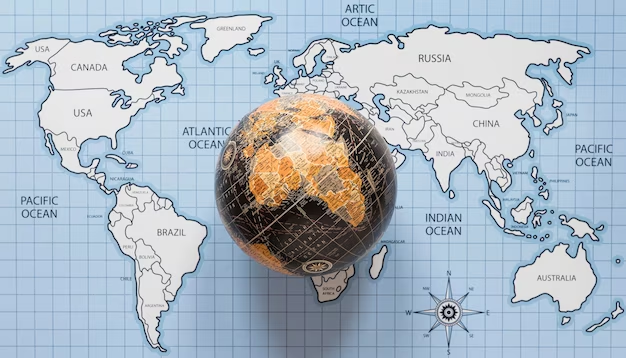
टैरिफ तनाव: वैश्विक और भारतीय परिप्रेक्ष्य
अमेरिका ने हाल ही में कई देशों के आयात पर टैरिफ बढ़ाने का फैसला किया है, जिसका उद्देश्य घरेलू उद्योगों को बढ़ावा देना और व्यापार घाटे को कम करना है। हालांकि, इस नीति ने वैश्विक व्यापार में अनिश्चितता पैदा कर दी है। भारत के लिए, यह विशेष रूप से महत्वपूर्ण है क्योंकि अमेरिका भारत का सबसे बड़ा व्यापार साझेदार है। भारत से अमेरिका को निर्यात होने वाले प्रमुख उत्पादों में फार्मास्यूटिकल्स, सूचना प्रौद्योगिकी सेवाएं, वस्त्र, और मशीनरी शामिल हैं।

टैरिफ में वृद्धि से भारतीय निर्यातकों को उच्च लागत का सामना करना पड़ सकता है, जिससे उनकी प्रतिस्पर्धात्मकता प्रभावित हो सकती है। दूसरी ओर, भारत ने भी जवाबी कार्रवाई के संकेत दिए हैं, जिसमें अमेरिकी उत्पादों पर टैरिफ बढ़ाने की संभावना शामिल है। यह स्थिति दोनों देशों के बीच व्यापार समझौते की बातचीत को और जटिल बना सकती है।
मोदी और वैंस मुलाकात: प्रमुख मुद्दे
प्रधानमंत्री मोदी और अमेरिकी उपराष्ट्रपति वैंस की मुलाकात में कई महत्वपूर्ण मुद्दों पर चर्चा होने की उम्मीद है। इनमें शामिल हैं:
- द्विपक्षीय व्यापार समझौता: दोनों नेता एक ऐसे व्यापार समझौते पर जोर दे सकते हैं जो बाजार पहुंच, टैरिफ संरेखण, और आपूर्ति श्रृंखला की मजबूती को सुनिश्चित करे। यह समझौता भारत को “चीन+1” रणनीति के तहत एक विश्वसनीय विकल्प के रूप में स्थापित करने में मदद कर सकता है।
- प्रौद्योगिकी और रक्षा सहयोग: भारत और अमेरिका के बीच रक्षा और प्रौद्योगिकी क्षेत्र में सहयोग बढ़ रहा है। वैंस की यात्रा इस दिशा में और प्रगति की उम्मीद करती है, जिसमें कृत्रिम बुद्धिमत्ता, साइबर सुरक्षा, और रक्षा उपकरणों के संयुक्त उत्पादन जैसे क्षेत्र शामिल हैं।
- आपूर्ति श्रृंखला लचीलापन: वैश्विक आपूर्ति श्रृंखला में व्यवधानों ने भारत को एक वैकल्पिक विनिर्माण केंद्र के रूप में उभारा है। वैंस और मोदी इस क्षेत्र में सहयोग को और मजबूत करने पर चर्चा कर सकते हैं, विशेष रूप से सेमीकंडक्टर और महत्वपूर्ण खनिजों के उत्पादन में।
- जलवायु और ऊर्जा: दोनों देश स्वच्छ ऊर्जा और जलवायु परिवर्तन से निपटने के लिए सहयोग कर रहे हैं। इस मुलाकात में हरित प्रौद्योगिकी और नवीकरणीय ऊर्जा परियोजनाओं पर चर्चा होने की संभावना है।
भारत की रणनीतिक स्थिति
प्रधानमंत्री मोदी और अमेरिकी उपराष्ट्रपति वैंस की मुलाकात में भारत एक मजबूत रणनीतिक स्थिति में है। वैश्विक आपूर्ति श्रृंखला में भारत की बढ़ती भूमिका, उसकी विशाल उपभोक्ता बाजार, और तकनीकी प्रगति ने उसे एक आकर्षक साझेदार बनाया है। “मेक इन इंडिया” और “आत्मनिर्भर भारत” जैसी पहलें भारत को वैश्विक विनिर्माण और नवाचार का केंद्र बनाने की दिशा में काम कर रही हैं।

हालांकि, टैरिफ तनाव भारत के लिए चुनौतियां भी पेश करते हैं। भारत को अपनी निर्यात रणनीति को फिर से समायोजित करने और वैकल्पिक बाजारों की तलाश करने की आवश्यकता हो सकती है। साथ ही, भारत को यह सुनिश्चित करना होगा कि वह अमेरिका के साथ व्यापार वार्ता में अपनी हितों की रक्षा करे।
सांस्कृतिक और कूटनीतिक आयाम
अमेरिकी उपराष्ट्रपति वैंस की जयपुर और आगरा की यात्रा भारत की सांस्कृतिक विरासत को प्रदर्शित करने का एक अवसर है। यह कदम दोनों देशों के बीच लोगों से लोगों के संपर्क को बढ़ाने में मदद करेगा। इसके अलावा, यह यात्रा भारत की “सॉफ्ट पावर” को मजबूत करने का एक मौका है, जो वैश्विक मंच पर उसकी छवि को और बेहतर बनाएगा।
कूटनीतिक स्तर पर, यह यात्रा भारत-अमेरिका संबंधों को और गहरा करने का एक अवसर है। दोनों देश हिंद-प्रशांत क्षेत्र में सहयोग, आतंकवाद के खिलाफ लड़ाई, और वैश्विक शांति और स्थिरता के लिए मिलकर काम कर रहे हैं। वैंस की यात्रा इन साझा लक्ष्यों को और मजबूत करेगी।
भविष्य की संभावनाएं
अमेरिकी उपराष्ट्रपति वैंस की यात्रा और मोदी के साथ उनकी मुलाकात भारत-अमेरिका संबंधों के लिए एक महत्वपूर्ण मोड़ हो सकती है। यदि दोनों देश टैरिफ तनावों को कम करने और एक मजबूत व्यापार समझौते पर सहमत हो पाते हैं, तो यह दोनों अर्थव्यवस्थाओं के लिए फायदेमंद होगा। इसके अलावा, प्रौद्योगिकी और रक्षा क्षेत्र में सहयोग दोनों देशों को वैश्विक मंच पर और मजबूत स्थिति में लाएगा।

हालांकि, चुनौतियां भी कम नहीं हैं। टैरिफ नीतियों से उत्पन्न अनिश्चितता, वैश्विक आर्थिक मंदी की आशंका, और भू-राजनीतिक तनाव इस प्रक्रिया को जटिल बना सकते हैं। भारत और अमेरिका को इन मुद्दों पर सावधानीपूर्वक बातचीत करनी होगी ताकि आपसी हितों को संतुलित किया जा सके।
निष्कर्ष
अमेरिकी उपराष्ट्रपति जे.डी. वैंस की दिल्ली यात्रा और प्रधानमंत्री नरेंद्र मोदी के साथ उनकी मुलाकात भारत-अमेरिका संबंधों में एक नया अध्याय शुरू करने का अवसर है। टैरिफ तनावों के बावजूद, दोनों देशों के पास सहयोग के कई क्षेत्र हैं, जो व्यापार, प्रौद्योगिकी, और रक्षा से लेकर जलवायु और सांस्कृतिक आदान-प्रदान तक फैले हुए हैं। यह यात्रा न केवल कूटनीतिक महत्व रखती है, बल्कि यह वैश्विक मंच पर भारत की बढ़ती भूमिका को भी रेखांकित करती है।
आने वाले दिनों में, यह देखना दिलचस्प होगा कि भारत और अमेरिका इन चुनौतियों का सामना कैसे करते हैं और अपने साझा हितों को कैसे आगे बढ़ाते हैं। वैंस की यह यात्रा एक मजबूत और समृद्ध भविष्य की नींव रख सकती है, बशर्ते दोनों पक्ष आपसी विश्वास और सहयोग के साथ आगे बढ़ें।