मानचित्रण का इतिहास

मानचित्रण

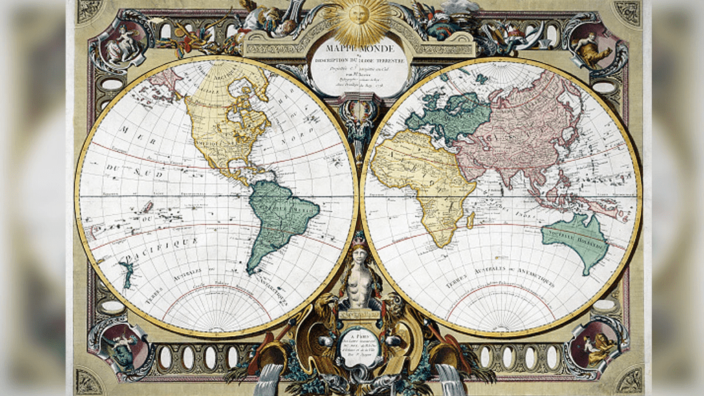
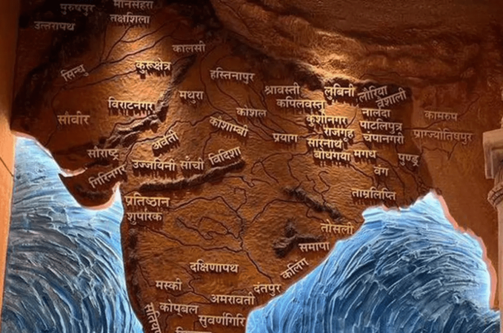
मानचित्रण का इतिहास: मेरी रचनाओं में से एक गीत – रेत में मौसम की लिखावट, टेढ़े-मेढ़े पत्थर पर माप, या गीतों और कला में डरा हुआ भूगोल – सभी संस्कृतियों में आम है। सबसे पुराने जीवित मानचित्र और चार्ट प्राचीन बेबीलोनिया और मिस्र से प्राप्त होते हैं। तीसरी सहस्राब्दी ईसा पूर्व तक, दोनों के पास आवश्यक गणितीय और प्रारूपण कौशल थे, और नौकरशाही बेबीलोनियन कार्टोग्राफी के सर्वेक्षण और मानचित्रण के लिए जिम्मेदार थी, जो ज्यादातर आंशिक थी, जबकि मिस्र के मानचित्रों में पौराणिक भूमि और जीवन के बाद के मार्गों का मानचित्रण किया गया था।

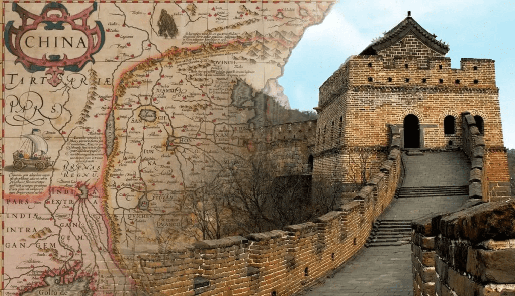
मानचित्रण का इतिहास:: यूनानियों ने पृथ्वी और ब्रह्मांड की प्रकृति की जांच करते हुए पश्चिमी मानचित्रकला की वैज्ञानिक नींव रखी। रोमनों ने अधिकतर संपत्तियों, नगर योजनाओं और सड़कों का मानचित्रण किया। साथ ही, चीनियों ने अपने मानचित्रों में कला और मौखिक कथा को शामिल किया, फिर भी वे सैन्य योजना और राज्य सुरक्षा को लेकर भी चिंतित थे। जापान और कोरिया भी अपने विश्व मानचित्रों के लिए चीन पर निर्भर थे और उन्होंने स्वयं को हाशिये पर डाल लिया।

Read also: ब्रह्माण्ड भाग-2

मानचित्रण का इतिहास: मध्य युग में धार्मिक मानचित्रकला का बोलबाला था। हालाँकि अरबों ने शास्त्रीय बौद्धिक परंपरा को बनाए रखा और अपनी इस्लामी मानचित्र-निर्माण परंपरा भी विकसित की।

मानचित्रण का इतिहास: प्रिंटिंग प्रेस के आविष्कार और भूगोल के लिए टॉलेमी की मार्गदर्शिका की पुनः खोज ने पश्चिमी यूरोप में वैज्ञानिक मानचित्रकला में पुनरुद्धार को बढ़ावा दिया, जो कि स्पेनिश और पुर्तगालियों द्वारा अफ्रीका, अमेरिका और स्पाइस द्वीपों की यात्राओं से तेज हुआ। फ्रांसीसी आधिकारिक भूमि सर्वेक्षण करने वाले पहले व्यक्ति बने, जिन्होंने 1787 तक 182 मानचित्र शीट तैयार कीं। ब्रिटिशों ने 19वीं शताब्दी की शुरुआत में भारत के महान त्रिकोणमितीय सर्वेक्षण का निर्माण करने के लिए फ्रांसीसी तकनीक को अपनाया।

मानचित्रण

ऑर्टेलियस और मर्केटर, अग्रणी मानचित्र निर्माता

मानचित्रण का इतिहास: एक युवा फ्लेमिश विद्वान और भूगोलवेत्ता के रूप में, अब्राहम ऑर्टेलियस (1527-1588) को मानचित्र पांडुलिपियों को कुशलतापूर्वक प्रकाशित करने और पुस्तकों और सिक्कों के संग्रह के लिए जाना जाता था। एक बार कार्डियोग्राफर के रूप में स्थापित होने के बाद, उन्होंने 1570 में थियेट्रम ऑर्बिसटेरारम, या थिएटर ऑफ़ द वर्ल्ड के प्रकाशन के साथ पुनर्जागरण की दुनिया में क्रांति ला दी। इसे प्रथम मॉडल एटलस के रूप में जाना जाता है।

थिएट्रम एक बड़ी सफलता साबित हुई और उसने यूरोपीय मानचित्र व्यापार के केंद्र को रोम और वेनिस से एंटवर, उसके घर में स्थानांतरित करने में मदद की। जब वह वहां है, और आप उसका घर हैं। 31 संस्करण और 7 भाषाओं में लगभग 7,300 प्रतियां मुद्रित की गईं और आज लगभग 1,630 डॉलर के बराबर कीमत पर बेची गईं, जिससे ऑर्टेलियस बहुत अमीर हो गया।

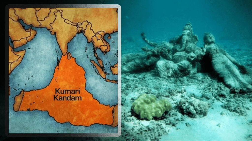
थिएटरम में ऑर्टेलियस मित्र और साथी फ्लेमिश कार्डियोग्राफर, जेरार्डस मर्केटर, 1512-1594 द्वारा तैयार विश्व प्रक्षेपण की एक पृष्ठ की कमी शामिल है। पहली बार 1569 में प्रकाशित, मर्केटर प्रोजेक्शन को नेविगेशन जोड़ने के लिए डिज़ाइन किया गया था। अक्षांश और देशांतर में सभी रेखाओं को सीधी रेखाओं के रूप में दर्शाए जाने से, नाविक अधिक आसानी से लंबी दूरी तक अपना रास्ता बना सकते हैं।
मानचित्रण

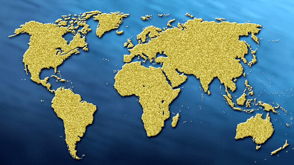
मानचित्रण का इतिहास: अपने मूल समुद्री उद्देश्य के बावजूद, मेरेटर प्रक्षेपण, संशोधन के साथ, 20वीं शताब्दी तक दुनिया का एक मानक द्वि-आयामी प्रतिनिधित्व बन गया। स्कूली बच्चों की पीढ़ियों ने मर्केटर प्रोजेक्शन का अध्ययन किया है, जिससे उन्हें विश्वास हो गया कि ग्रीनलैंड और अफ्रीका लगभग एक ही आकार के हैं, हालांकि वे वास्तव में 14 गुना बड़े हैं।

आधुनिक मानचित्र

मानचित्रण का इतिहास: सर्वेक्षण और मानचित्रण की वैज्ञानिक विधियों का 17वीं, 18वीं और 19वीं शताब्दी में काफी विस्तार हुआ, आंशिक रूप से अधिक परिष्कृत गणितीय अनुप्रयोगों के साथ-साथ बड़े क्षेत्रों के कठोर और व्यापक सर्वेक्षणों के कारण।

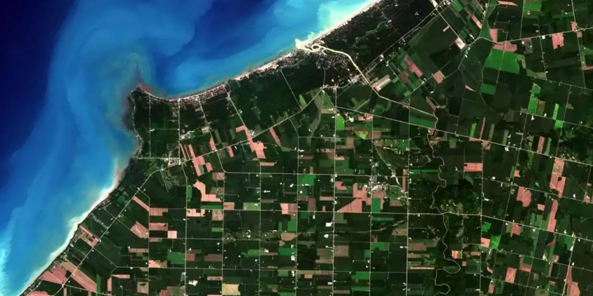
आज सर्वेक्षण में अक्सर रिमोट सेंसिंग के तत्वों का उपयोग किया जाता है – दूर से किसी वस्तु या क्षेत्र के बारे में जानकारी प्राप्त करना। किसी ऊंची इमारत की चोटी से किसी शहर को या ऊंचे पहाड़ की चोटी से किसी गांव को देखना रिमोट सेंसिंग का एक रूप है। मानचित्र निर्माता समान परिणाम प्राप्त करने के लिए अधिक परिष्कृत तरीकों का उपयोग करते हैं।

एरियल फोटोग्राफी, जिसका उपयोग कुछ हद तक प्रथम विश्व युद्ध के दौरान किया गया था, द्वितीय विश्व युद्ध के दौरान मानचित्र-निर्माण में रिमोट सेंसिंग उपकरण के रूप में व्यापक हो गई। इसने सर्वेक्षकों की अधिकांश कठिनाइयों को समाप्त कर दिया और कुछ अन्य दुर्गम स्थानों को सटीक सर्वेक्षण आवंटित कर दिया।

रडार, या रेडियो तरंगों और सोनार, या ध्वनि तरंगों द्वारा रिमोट सेंसिंग, समुद्र तल पर भूमि की सतह की विशेषताओं को रिकॉर्ड करने का एक और तरीका प्रदान करता है। दोनों तरीकों में, दूरी की गणना लक्ष्य क्षेत्र तक पहुंचने में लगने वाले समय से की जाती है। दूर से संवेदित छवियां उनके द्वारा दर्शाए गए रिज़ॉल्यूशन के प्रकार के आधार पर भिन्न होती हैं।

स्थानिक रिज़ॉल्यूशन से तात्पर्य यह है कि कोई छवि कितनी तेज़ है। अधिक दूरी को आमतौर पर धुंधली छवियों के बराबर माना जाता है।

स्पेक्ट्रल रिज़ॉल्यूशन से तात्पर्य है कि प्रकाश स्पेक्ट्रम के किस हिस्से को कैप्चर किया जा रहा है और इसमें दृश्य प्रकाश या अवरक्त प्रकाश जैसी तरंग दैर्ध्य शामिल हो सकते हैं।

अस्थायी समाधान प्रतिनिधित्व की गई समय सीमा को संदर्भित करते हैं। यह तकनीक समय के साथ परिवर्तन दिखाने के लिए किसी क्षेत्र की अनुक्रमिक छवियों का उपयोग करती है।

Read more: ब्रह्माण्ड

THE MAPPING HISTORY

MAP

Song from one of my makings—weather scribbles in sand, measurement on a chiseled stone, or scared geography in songs and art—is common to all cultures. The earliest surviving map and charts come from ancient Babylonia and Egypt. By the third Millennium B.C., both possessed the necessary mathematical and drafting skills, and the bureaucracy was responsible for the surveying and mapping of the Babylonian cartography, which was mostly partial, whereas Egyptian maps mapped mythical land and routes to afterlife

The Greeks laid the scientific foundation of Western cartography while investigating the nature of the Earth and the universe. The Romans mostly mapped properties, town plans, and roads. At the same time, the Chinese incorporated art and verbal narrative into their maps, yet they were also concerned with military planning and state security. Japan and Korea also relied on China for their world maps, adding themselves to the fringes.

Read also: THE UNIVERSE, PART-2

Religious cartography held sway in the middle Ages. Although Arabs maintained classical intellectual traditions and developed their own Islamic map-making traditions as well,.

The invention of the printing press and the rediscovery of Ptolemy’s guide to geography sparked a revival in scientific cartography in western Europe, asseverated by voyages by the Spanish and Portuguese to Africa, America, and the Spice Islands. The French became the first to conduct an official land survey, producing 182 map sheets by 1787. The British adopted French technique to produce the Great Trigonometric Survey of India in the early 19th century.

MAP

ORTELIUS & MERCATOR, PIONEERING MAPMAKERS

As a young Flemish scholar and geographer, Abraham Ortelius (1527–1588) was known for skillfully illuminating map manuscripts and for his collection of books and coins. Once established as a cardiographer, he revolutionized the Renaissance world with the publication in 1570 of Theatrum Orbis Terrarum, or Theater of the World. It is known as the first model atlas.

The Theatrum proved a huge success and helped transfer the center of the European map trade from Rome and Venice to Antwer, his home. when is there, and you are his home. Some 7,300 copies were printed in 31 editions and 7 languages and sold at a cost equivalent to about 1,630 dollars today, making Ortelius very wealthy.

The Theatrum include a one-page reduction of the world projection drawn by the Ortelius friend and fellow Flemish cardiographer, Gerardus Mercator, 1512–1594. First published in 1569, the Mercator projection was designed to add navigation. With all lines in latitude and longitude depicted as straight lines, mariners could more easily plot a course over a long distance.

MAP

Despite its original nautical purpose, the Merator projection, with modification, became a standard two-dimensional representation of the world until well into the 20th century. Ages of schoolchildren have concentrated on Mercator projection, which persuaded them to think that Greenland and Africa were generally a similar size, in spite of the fact that they are, as a matter of fact, multiple times bigger.

Modern Maps

Scientific methods of surveying and mapping expanded greatly in the 17th, 18th, and 19th centuries, in part due to more sophisticated mathematical applications as well as rigorous and comprehensive surveys of large areas.

Surveying today often employs elements of remote sensing-obtaining information about an object or an area from a distance. Peering down on a city from the highest point of a tall structure or on a town from the highest point of a tall mountain is a type of remote detection. Map maker’s use more sophisticated methods to get similar results.

Ariel photography, used to some extent during World War 1, became widespread during World War 2 as a remote sensing tool in map-making. It eliminated much of the legwork for surveyors and allotted precise surveying to some other inaccessible places.

Remote sensing by radar, or radio waves, and Sonar, or sound waves, provides another way to record surface features of the land on the ocean floor. In both methods, distance is calculated from the time it takes to reach the target area. Remotely detected pictures fluctuate by the sort of goal they depict.

Spatial resolution refers to how sharp an image is. Greater distance is usually equated with fuzzier images.

Spectral resolution refers to which part of the light spectrum is being captured and can include such wavelengths as visible light or infrared light.

Temporal resolutions refer to the time frame represented. The technique uses sequential images of an area to show changes over a period of time.

Read more: History of Mapping

ब्रह्माण्ड भाग-2

ब्रह्माण्ड

ब्रह्मांड: आकाशीय पिंड

ब्रह्माण्ड कम से कम 99.99% खाली स्थान है। इस विशाल, अंधेरे शून्य में तैरते हुए। वहाँ सभी प्रकार की विभिन्न वस्तुएँ हैं, जिन्हें खगोलशास्त्री खगोलीय पिंड कहते हैं; इनमें धूल के कणों से लेकर ग्रह, तारे और आकाशगंगाएँ तक शामिल हैं। हमारे सौर मंडल में एक तारा, सूर्य और ग्रहों और चंद्रमाओं का एक बड़ा परिवार शामिल है जो उसी गैस के बादल से बने हैं जिसने सूर्य को जन्म दिया था। हाल के वर्षों में, सैकड़ों अन्य तारों के आसपास ग्रह देखे गए हैं, जिससे पता चलता है कि हमारा सौर मंडल हमारी आकाशगंगा में अरबों में से एक हो सकता है।

ब्रह्माण्ड: क्षुद्र ग्रह

सौर मंडल के निर्माण से बचे चट्टानी पिंडों को क्षुद्रग्रह कहा जाता है। इनका आकार बोल्डर से लेकर बौने ग्रह के आकार के करीब के पिंडों तक होता है।

ब्रह्माण्ड: कोमेट

ये सौरमंडल के बाहरी हिस्से से आए बर्फ के टुकड़े हैं। कुछ लोग जैसे-जैसे सूर्य के निकट आते हैं और उससे गर्म होते हैं, गैस और धूल की लंबी पूँछें विकसित हो जाती हैं।

ब्रह्माण्ड: चंद्रमा

चंद्रमा, जिसे प्राकृतिक उपग्रह भी कहा जाता है, एक पिंड है जो किसी ग्रह की परिक्रमा करता है। पृथ्वी के पास केवल एक चंद्रमा है, लेकिन बृहस्पति ग्रह के पास लो सहित 67 चंद्रमा हैं।

ब्रह्माण्ड: बौना गृह

द्वार ग्रह स्टेरॉयड से बड़े लेकिन ग्रहों से छोटे होते हैं। ग्रहों की तरह इनका आकार भी गोल है। प्लूटो को बौने ग्रह के रूप में जाना जाता है।

ALSO READ: विश्व भूगोल

ब्रह्माण्ड: ग्रह

यह एक बड़ी और लगभग गोलाकार वस्तु है जो एक तारे की परिक्रमा करती है और अपने कक्षीय पथ से मलबे को हटा देती है। सौर मंडल में 8 ग्रह हैं।

ब्रह्माण्ड: सितारे

गैसों के ये चमकदार गोले, जैसे सूर्य, अपनी परमाणु ऊर्जा उत्पन्न करके चमकते हैं, और तारे विभिन्न प्रकार, तापमान और आकार में आते हैं।

ब्रह्माण्ड: नाब्युला

अंतरिक्ष में गैस और धूल के चमकते बादल को निहारिका कहा जाता है। कुछ निहारिकाएँ मरते तारों द्वारा निर्मित मलबे के बादल हैं; दूसरे नये सितारों को जन्म देते हैं।

ब्रह्माण्ड

समय में पीछे मुड़कर देखना

क्योंकि प्रकाश को यात्रा करने में समय लगता है, जब हम अंतरिक्ष में देखते हैं, तो हम समय में पीछे देख रहे होते हैं। दिखाई देने वाली सबसे दूर की वस्तुएँ हबल टेलीस्कोप द्वारा खींची गई आकाशगंगाएँ हैं। हमने उन्हें वैसे ही देखा जैसे वे 30 अरब साल पहले थे। ब्रह्माण्ड इनसे कहीं आगे तक फैला हुआ है, लेकिन इससे अधिक दूर तक वस्तुओं को देखना असंभव है क्योंकि उनके प्रकाश को उन तक पहुँचने का समय नहीं मिला है।

सबसे दूर की वस्तुएँ

हबल टेलीस्कोप से ली गई इस तस्वीर में सबसे कमजोर आकाशगंगाओं की रोशनी को पृथ्वी तक पहुंचने में 3 अरब साल लग गए।

क्या बात है ?

ब्रह्मांड में हम जो पदार्थ देख सकते हैं उनमें से 98 प्रतिशत तत्व हाइड्रोजन और हीलियम हैं। लेकिन जिस तरह से तारे और आकाशगंगाएँ गुरुत्वाकर्षण द्वारा खींचे जाते हैं, उसका हिसाब लगाने के लिए पर्याप्त सामग्री नहीं लगती है। परिणामस्वरूप, खगोलविदों का मानना है कि आकाशगंगाओं में काला पदार्थ होता है, जिसे हम देख नहीं सकते। ब्रह्माण्ड का विस्तार करने वाली एक अज्ञात शक्ति भी है, जिसे डार्क एनर्जी के नाम से जाना जाता है।

क्या कोई वहां है?

विज्ञान में सबसे बड़े प्रश्नों में से एक यह है कि क्या जीवन पृथ्वी पर अद्वितीय है या अन्य दुनिया में उत्पन्न हुआ है। और यदि जीवन कहीं और प्रकट हुआ है, तो क्या बुद्धिमान प्राणी विकसित हो सकते हैं? वैज्ञानिकों ने अलौकिक प्राणियों के संकेतों को देखने और सुनने के लिए एक परियोजना स्थापित की है, और हमारे अस्तित्व के बारे में किसी भी एलियंस को सूचित करने के लिए सितारों को संदेश भेजे गए हैं।

अरेसिबो संदेश

1974 में, वैज्ञानिकों ने स्टार क्लस्टर M13 की ओर एक रेडियो संदेश प्रसारित करने के लिए प्यूर्टो रिको में विशाल अरेसीबो रेडियो टेलीस्कोप का उपयोग किया। संदेश में प्रतीक (दाएं) शामिल है जो मानव का प्रतिनिधित्व करता है, हमारी आधार-10 गिनती प्रणाली, डीएनए अणु और सौर मंडल एलियंस को शामिल करने के गंभीर प्रयास की तुलना में एक प्रचार स्टंट है, प्रसारण को एम 13 तक पहुंचने में 25,000 साल लगेंगे, और एक जवाब आने में 25,000 साल लगेंगे.

ब्रह्माण्ड

पायनियर पट्टिका

रोबोटिक अंतरिक्ष यान पायनियर 10 और पायनियर 11 ने 1973-74 में बृहस्पति और शनि ग्रह का दौरा किया और फिर गहरे अंतरिक्ष में उड़ान भरी। यदि एलियंस कभी भी अंतरतारकीय अंतरिक्ष के माध्यम से बहते हुए एक यान की खोज करते हैं, तो उन्हें पृथ्वी से एक संदेश के साथ उत्कीर्ण एक स्वर्ण-ग्रह पट्टिका मिलेगी।

सेटी

सेटी (परलौकिक बुद्धि की खोज) परियोजना में शामिल खगोलविदों ने विदेशी सभ्यताओं द्वारा प्रसारित कृत्रिम रेडियो संकेतों की खोज में आकाश को स्कैन करने के लिए शक्तिशाली रेडियो दूरबीनों का उपयोग किया। SETI परियोजना 1960 से चल रही है, लेकिन कुछ झूठी चेतावनियों के बावजूद, इसे अब तक विदेशी संकेतों का कोई निर्णायक सबूत नहीं मिला है।

MORE READ: Geography

THE UNIVERSE PART-2

THE UNIVERSE

THE UNIVERSE: CELESTIAL BODIES

The universe is at least 99.99% empty space. Floating in this vast, dark void. There are all sorts of different objects, which astronomers call celestial bodies; they range from grains of dust to planets, stars, and galaxies. Our planetary group incorporates a star, the sun, and an enormous group of planets and moons that are framed by the very haze of gas that brought forth the sun. In recent years, Planets have been seen around hundreds of other stars, showing that our solar system maybe one of billions in our galaxy.

Asteroids

Rocky lumps left over from the formation of the solar system are called asteroids. They range in size from stones to bodies near the size of a bantam planet.

Read also: THE WORLD GEOGRAPHY

Comet

These are chunks of ice from the outer reaches of the solar system. Some develop long tails of gas and residue as they approach the sun and are warmed by it.

Moon

A moon, also called a natural satellite, is a body that orbits a planet. Earth has only one moon, but the planet Jupiter has 67, including Lo.

Dwarf Planet

Dwar planets are larger than steroids but smaller than planets. Like planets, they are round in shape. Pluto is best known as a dwarf planet.

Planet

It is a large and nearly spherical object that orbits a star and has swept its orbital path clear of debris. The solar system has 8 planets.

Stars

These brilliant bundles of gases, for example, the sun, sparkle by producing their own atomic power, and stars arrive in many kinds, temperatures, and sizes.

Nebula

A glowing cloud of gas and dust in space is known as a nebula. Some nebulae are clouds of wreckage created by dying stars; others give birth to new stars.

THE UNIVERSE

THE UNIVERSE: Because light takes time to travel, when we look into space, we are looking back in time. the most distant objects visible are galaxies photographed by the Hubble Telescope. We saw them as they were 30 billion years ago. The universe extends far beyond these, but it is impossible to see objects much further because their light has not had time to reach them.

Furthest Objects

The light from the faintest galaxies in this photo from the Hubble Telescope took 3 billion years to reach Earth.

What is the matter?

THE UNIVERSE: The elements hydrogen and helium make up 98 percent of the matter we can see in the universe. But there does not seem to be enough matter to account for the way stars and galaxies are pulled by gravity. As a result, astronomers think galaxies contain dark matter, which we cannot see. There is likewise an obscure power that makes the universe extend, known as dull energy.

Is there anyone out there?

One of the biggest questions in science is whether life is unique to Earth or has arisen in other worlds. And if life has appeared elsewhere, could intelligent beings have evolved? Scientists have set up a project to watch and listen for signals from extraterrestrials, and messages have been sent to the stars to inform any aliens out there of our existence.

ARECIBO MESSAGE

THE UNIVERSE: In 1974, scientists used the giant Arecibo Radio Telescope in Puerto Rico to broadcast a radio message towards the star cluster M13. The message contains a symbol (right) to represent human beings, our base-10 counting system, DNA molecules, and the solar system. This is more of a publicity stunt than a serious attempt to contain aliens; the broadcast will take 25,000 years to reach M13, and a reply will take 25,000 years to return.

THE UNIVERSE

PIONEER PLAQUE

The robotic spacecraft pioneers 10 and 11 visited the planets Jupiter and Saturn in 1973–74 and then flew off into deep space. If aliens ever discover a craft drifting through interstellar space, they will find a gold-planet plaque engraved with a message from Earth.

SETI

Astronomers involved in the Seti (search for extraterrestrial intelligence) project used powerful radio telescopes to scan the skies in search of artificial radio signals broadcast by alien civilizations. The SETI project has been running starting around 1960, however it has up to this point tracked down no convincing proof of outsider signs, regardless of a few misleading problems.

Read more: Welcome to the Universe

विश्व भूगोल

विश्व भूगोल

विश्व

विश्व भूगोल: मिस्र, फोनीशियन और चीनी भौगोलिक समझ जैसी प्राचीन संस्कृतियाँ, लेकिन उनमें से कुछ ही अभिलेख बचे हैं, और इसलिए यूनानी आज के प्रारंभिक ज्ञान का मुख्य स्रोत बन गए हैं। होमर के महाकाव्य, द लियाड और द ओडिसी, नौवीं शताब्दी ईसा पूर्व में वापस आते हैं। वे यूनानियों को दुभाषियों, यात्रियों और दूर देशों के पर्यवेक्षकों के रूप में प्रकट करते हैं। वे वैज्ञानिक जांच में भी उत्कृष्ट थे।

15वीं, 16वीं और 17वीं शताब्दी में यूरोपीय और एशियाई दोनों खोजकर्ताओं द्वारा अन्वेषण के उत्कर्ष के दौरान भूभौतिकी ज्ञान तेजी से उन्नत हुआ। प्रत्येक यात्रा में मानचित्रण, सर्वेक्षण और मसाला एकत्र करना स्टॉक गतिविधियाँ बन गईं।

Read also: ब्रह्मांड

21वीं सदी में, कुछ कंप्यूटर क्लिक से पृथ्वी की सतह के अधिकांश भाग की तस्वीरें या मानचित्र संबंधी जानकारी प्राप्त की जा सकती है। हम मानचित्र पर मार्ग दर्शाने की आवश्यकता के बिना, लगभग कहीं भी जाने के लिए दिशा-निर्देश प्राप्त करने की क्षमता को मान लेते हैं।

आधुनिक विज्ञान और सूचना संग्रहण ने भूगोलवेत्ताओं को पहले से कहीं अधिक अंतर्दृष्टि प्रदान की है, और आधुनिक तकनीक इसे दुनिया भर में साझा करने की अनुमति देती है, लेकिन कई लोगों के लिए, तथ्यों और शब्दों में संदर्भ का अभाव है। भूगोल की समझ, भौतिक और सांस्कृतिक दोनों, उस संदर्भ को और अधिक आवश्यक और महत्वपूर्ण बनाती है। वैश्विक बातचीत और पृथ्वी के भविष्य के लिए जिम्मेदारी साझा करना हम सभी को जोड़ता है।

विश्व

टॉलेमी/प्राचीन भूगोलवेत्ता

ग्रीक वंश के मिस्र में जन्मे क्लॉडियस टॉलेमी (लगभग 90-168 ई.) ने कार्टोग्राफी, गणित और खगोल विज्ञान के ग्रीक-रोमन विश्व ज्ञान को संश्लेषित करने वाले कार्य का एक समूह बनाया। उनके आठवें खंड, भूगोल, ने विश्व मानचित्र और 26 क्षेत्रीय मानचित्रों सहित एक शब्द मानचित्र तैयार करने के लिए निर्देश और जानकारी प्रदान की।

उन्होंने कई मानचित्र प्रक्षेपण भी खोजे और लगभग 8,000 स्थानों के नाम और उनके निर्देशांक की एक सूची प्रदान की। अल्मागेस्ट, सौर मंडल के खगोल-भौगोलिक मॉडल पर उनका 13-खंड का ग्रंथ, और उनकी चार पुस्तकें ट्रट्राबिब्लोस ने ज्योतिष को अधिक वैज्ञानिक मामले के साथ समेटने की कोशिश की, जो इस्लामी विद्वानों द्वारा किए गए अरबी अनुवादों के माध्यम से फैला और पूर्वी और पश्चिमी भूगोल और कार्टोग्राफी विचारों को प्रभावित किया।

भूगोल का दायरा

आज विश्व भूगोल स्थान में निहित है, लेकिन इसमें मानचित्र पर स्थान के नामों की स्थिति से कहीं अधिक शामिल है; यह कई अलग-अलग विषयों के तरीकों और ज्ञान को एकीकृत करता है, और आय भौतिक और सामाजिक विज्ञान दोनों से होकर गुजरती है। यह निर्धारित करने के लिए इन सभी विषयों का उपयोग करता है। चीज़ें किसी विशेष स्थान पर या विशेष स्थानिक पैटर्न के अनुसार क्यों घटित होती हैं?

कॉर्पोरेट भूविज्ञान और जलवायु विज्ञान, जीव विज्ञान, पारिस्थितिकी, जल विज्ञान और अन्य प्राकृतिक विज्ञानों में भौतिक भूगोल। मानव विश्व भूगोल में समाजशास्त्र, अर्थशास्त्र, राजनीति विज्ञान, इतिहास, जनसांख्यिकी और अन्य सामाजिक विज्ञान शामिल हैं। कार्टोग्राफी, जो मानचित्र बनाने की कला और विज्ञान है, भौगोलिक सेटिंग्स का ग्राफिक प्रतिनिधित्व प्रदान करती है।
विश्व भूगोलवेत्ता अपने डेटा एकत्रीकरण, विश्लेषण और प्रतिनिधित्व में अन्य उपकरणों का भी उपयोग करते हैं, जिनमें सांख्यिकीय तस्वीरें, दूर से खींची गई छवियां जैसे उपग्रह तस्वीरें और कंप्यूटर-जनित ग्राफिक्स शामिल हैं।

विश्व

मानचित्रों में विश्व

सोचिए कि एक संतरे को छीलना और उसके छिलके के टुकड़ों को मेज पर दबाकर रखना कितना कठिन है। यह सादृश्य मानचित्र निर्माता के सामने आने वाली चुनौती का प्रतिनिधित्व करता है, जो गोलाकार ग्रह पृथ्वी को एक सपाट दृश्य प्रतिनिधित्व में बदलने का प्रयास करता है। किसी गोले की सतह को जीवंत बनाने की चुनौती से निपटने के लिए, सपाट मानचित्रकार उन आकृतियों का उपयोग करते हैं जो खुद को समतल करने में सक्षम होती हैं, जैसे योजनाएं और सिलेंडर जिन्हें विकास योग्य सतहों के रूप में जाना जाता है।

विकास योग्य सतहों पर गणितीय गणना लागू करके, वे पृथ्वी की विशेषताओं को सपाट रूपों में बदल सकते हैं। उन रूपों को प्रक्षेपण कहा जाता है और वे मानचित्र-निर्माण की चुनौती का प्रतिनिधित्व करते हैं।

सदियों से, प्रक्षेपण अनिवार्य रूप से होते रहे हैं और परिणामस्वरूप विकृतियाँ होती हैं। मानचित्र आकार की पसंद से उन विकृतियों को कुछ हद तक नियंत्रित किया जा सकता है, जो इस बात पर निर्भर करता है कि मानचित्रकार के माध्यम से ग्रह का कौन सा हिस्सा सबसे अधिक रुचि रखता है।

केवल वहीं मानचित्र पूरी तरह से सटीक होगा जहां सतह सीधे ग्लोब को छूती है। संपर्क के इन बिंदुओं से दूर, पृथ्वी की विशेषताएं सपाट होने के लिए खिंची हुई या सिकुड़ी हुई हो जाती हैं।

Read more: Geography

THE WORLD GEOGRAPHY

THE WORLD GEOGRAPHY

WORLD

Ancient cultures such as the Egyptian, Phoenician, and Chinese geographical understanding, but few of those records survive, and so the Greeks have become today’s main source of early knowledge. Homers epics, The Liad and the Odyssey, return in the ninth century BC. They reveal the Greeks as interpreters, travelers, and observers of distant lands. They also excelled in scientific inquiry.

Geophysics knowledge advanced exponentially during the heyday of exploration by both European and Asian explorers in the 15th, 16th, and 17th centuries. Mapping, surveying, and spice collecting became stock activities on every voyage.

Read also: ब्रह्मांड

In the 21st century, a few computer clicks can bring photos or map information to much of the earth’s surface. We take for granted the ability to get directions to almost anywhere we need to go, without needing to plot the course on a map.

Modern science and information gathering have given geographers more insight then ever before, and modern technology allows it to be shared world-wide, but for many people, facts and terms lack context. An understanding of geography, both physical and cultural, makes that context ever more necessary and important. Global interactions and sharing responsibility for the earth’s future connect us all.

WORLD

Ptolemy / ANCIENT GEOGRAPHER

Born in Egypt of a Greek family, Claudius Ptolemy (ca. A.D. 90–168) created a body of work synthesizing the Greco-Roman world knowledge of cartography, mathematics, and astronomy. His eighth volume, Geography, offered instructions and information for preparing a word map, including a world map and 26 regional maps. He also found a number of map projections and provided a list of some 8,000 place names and their coordinates. Almagest, his 13-volume treatise on the astronomy-geocentric model of the solar system, and his four books, Tetrabiblos, tried to Reconcile astrology with more scientific matter Spread through Arabic translations made by Islamic scholars and influenced near eastern and western geography and cartography thoughts for centuries.

THE SCOPE OF GEOGRAPHY

Today, the world is rooted in location, but it involves more than just the position of place names on a map; it integrates methods and knowledge from many different disciplines, and income passes through both the physical and social sciences. It uses all these disciplines to determine why things occur in a specific area or as per specific spatial examples?.

Physical geography in corporate geology and climatology, biology, ecology, hydrology, and other natural sciences. Human geography includes sociology, economics, political science, history, demography, and other social sciences. Cartography, which is the art and science of making maps, provides graphic representations of geographic settings.

The World Geographers also use other tools in their data gathering, analysis, and representation, including statistical photographs, remotely captured images such as satellite photos, and computer-generated graphics.

WORLD

THE WORLD IN MAPS

Think of how hard it is to peel an orange and press the resulting pieces of peel down flat on a table. That analogy represents the challenge faced by the map maker, who attempt to turn the spherical planet earth into a flat visual representation. To handle the test of getting the outer layer of a circle to life, level map makers use shapes that lend themselves to straightening, for example, plans and chambers known as developable surfaces.

By applying numerical estimations to the developable surfaces, they can change earth highlights into level structures. Those forms are called projections and represent the challenge of map-making.

Through the centuries, projections have inevitably resulted in distortions. Those distortions can be controlled to some degree by the choice of map shape, which depends on which part of the planet is of most interest to the cartographer.

Only where the surface directly touches the globe will the map be completely accurate. Away from these points of contact, earthen features become stretched or squeezed in order to become flat.

Read more: Geography

ब्रह्मांड

ब्रह्मांड

ब्रह्मांड

ब्रह्मांड अस्तित्व का छिद्र है – संपूर्ण स्थान, पदार्थ, ऊर्जा और समय। ब्रह्मांड को इतना देखा जाता है कि यह अकल्पनीय है, लेकिन हम जानते हैं कि 13.8 अरब साल पहले बिग बैंग नामक एक विस्फोटक घटना के साथ इसकी शुरुआत के बाद इसका विस्तार हो रहा है।

ब्रह्मांड को समझना

लोग ब्रह्मांड को एक विशाल क्षेत्र के रूप में सोचते थे, लेकिन अब हम जानते हैं कि चीजें इतनी सरल नहीं हैं। ब्रह्माण्ड का संभवतः कोई केंद्र या बाहरी किनारा नहीं है; इसका केवल एक अंश ही हमें दिखाई देता है। अवलोकनीय ब्रह्माण्ड इससे कहीं अधिक बड़ा हो सकता है, संभवतः अनन्त गुना। एक सघन ब्रह्मांड अपने आप को एक बंद आकार में मोड़ लेगा। एक सीधी रेखा में यात्रा करने से आप अपने शुरुआती बिंदु पर वापस आ जाएंगे।

Read also: विश्व का एक दृश्य

अंतरिक्ष का आकार

ब्रह्मांड में पदार्थ से गुरुत्वाकर्षण बल के कारण अंतरिक्ष के तीन आयाम एक चौथे आयाम में मुड़ जाते हैं जिसे हम नहीं देख सकते हैं। इसकी कल्पना करना कठिन है, इसलिए वैज्ञानिक इस विचार को समझाने के लिए द्वि-आयामी रबर शीट के रूपक का उपयोग करते हैं। ब्रह्माण्ड का द्रव्यमान इस रबर शीट को तीन तरीकों में से एक में मोड़ सकता है, यह इस बात पर निर्भर करता है कि ब्रह्माण्ड पदार्थ से कितना सघन रूप से भरा हुआ है।

अधिकांश वैज्ञानिक अब सोचते हैं कि ब्रह्मांड का आकार चपटा है। यदि ब्रह्मांड पर्याप्त घना नहीं है, तो यह एक खुले आकार में फैल सकता है, जिससे इसका आकार अनंत हो जाएगा और इसका कोई बाहरी किनारा नहीं होगा। पदार्थ की सही मात्रा ही ब्रह्मांड को एक सपाट आकार देगी। इसका आकार भी अनंत होगा, जिसका कोई बाहरी किनारा नहीं होगा।

ब्रह्मांड

ब्रह्मांड इतना विशाल है कि हम बड़े पैमाने पर छलांग लगाए बिना इसके आकार की सराहना नहीं कर सकते। चित्रों की इस शृंखला में, प्रत्येक चरण अपने दाहिनी ओर की छवि के एक सूक्ष्म कण का प्रतिनिधित्व करता है। अंतरिक्ष में विशाल दूरियों से निपटते समय, किलोमीटर पर्याप्त बड़े नहीं होते हैं। इसके बजाय, खगोलशास्त्री प्रकाश की गति को एक मापदण्ड के रूप में उपयोग करते हैं। प्रकाश इतना तेज़ है कि यह एक सेकंड में पृथ्वी के चारों ओर 7.5 बार चक्कर लगा सकता है। एक प्रकाश वर्ष वह दूरी है जो प्रकाश एक वर्ष में तय करता है – लगभग 10 ट्रिलियन किमी या 6 ट्रिलियन मील।

पृथ्वी और चंद्रमा

पृथ्वी 12,756 किमी या 7,926 मील चौड़ी है। अंतरिक्ष में हमारा निकटतम पड़ोसी चंद्रमा है, जो 384,400 किमी या 238,855 मील की दूरी पर पृथ्वी की परिक्रमा करता है। यदि पृथ्वी एक फुटबॉल के आकार की होती, तो चंद्रमा लगभग 21 मीटर या 69 फीट दूर एक तरबूज के आकार का होता।

सौर परिवार

8 ग्रहों का सूर्य परिवार 9 अरब किमी या 5.6 अरब मील चौड़े क्षेत्र पर कब्जा करता है। यदि पृथ्वी एक फुटबॉल होती, तो सौर मंडल के इस हिस्से में चलने में 5 दिन लगते, और निकटतम तारा 58 साल की पैदल दूरी पर होता।

तारकीय पड़ोस

सूर्य से निकटतम तारा प्रॉक्सिमा सेंटॉरी है, जो केवल 4 से 4 प्रकाश वर्ष दूर है। सूर्य से 50 प्रकाश वर्ष के भीतर लगभग 2000 तारे हैं; ये हमारे तारकीय पड़ोस का निर्माण करते हैं, जो आकाशगंगा का एक छोटा सा अंश है।

ब्रह्मांड

मिल्की वे आकाश गंगा

मिल्की वे आकाशगंगा 200 अरब तारों का एक विशाल बादल है। इसका आकार एक सपाट डिस्क से घिरे केंद्रीय उभार के साथ एक के पीछे एक रखे हुए गौरव अंडों की जोड़ी जैसा दिखता है। यह डिस्क के पार 1 लाख प्रकाश वर्ष और उभार के माध्यम से 2000 प्रकाश वर्ष गहराई मापता है।

आकाशगंगाओं का स्थानीय समूह

आकाशगंगा अवलोकनीय ब्रह्मांड में संभवतः 7 ट्रिलियन आकाशगंगाओं में से एक है जो समूहों में मौजूद हैं जिन्हें क्लस्टर कहा जाता है। गुरुत्वाकर्षण के कारण, आकाशगंगा एक क्लस्टर का हिस्सा है जिसे स्थानीय समूह के रूप में जाना जाता है, जो लगभग 10 मिलियन प्रकाश वर्ष चौड़ा है।

सुपर क्लस्टर

आकाशगंगा के समूह और भी बड़े समूह में मौजूद हैं जिन्हें सुपर क्लस्टर कहा जाता है। हम कन्या सुपर क्लस्टर में रहते हैं, जो गैर-ब्रह्मांड के लाखों सुपर क्लस्टर में से एक है। इनके बीच विशाल खाली क्षेत्र हैं जिन्हें ब्रह्मांडीय शून्यता कहा जाता है।

ब्रह्मांड

ऐसा माना जाता है कि सुपरक्लस्टर फिलामेंट का एक विशाल जाल बनाते हैं जो विशाल रिक्तियों से भरा होता है जिसमें कोई आकाशगंगा नहीं होती है। ब्रह्माण्ड का वास्तविक आकार एक रहस्य है और इसका केवल एक अंश ही हमें दिखाई देता है। ब्रह्मांड आकार में अनंत भी हो सकता है।

Read more: Read more: What is the universe?

THE UNIVERSE

THE UNIVERSE

UNIVERSE

The universe is the hole of existence—all of space, matter, energy, and time. The universe is so watched as to be unimaginable, but we do know that it is expanding following its beginning 13.8 billion years ago in an explosive event called the Big Bang.

UNDERSTANDING THE UNIVERSE

People used to think of this thing as a giant sphere, but we now know that things are not so simple. The universe probably has no center or outer edge; only a fraction of it is visible to us. The observable universe may be vastly bigger than this, perhaps infinitely so. A dense universe would bend itself into a closed shape. Traveling in a straight line would bring you back to your starting point.

Read also: A VIEW OF THE WORLD

The shape of space

The three dimensions of space are bent by the force of gravity from matter in the universe into a fourth dimension that we cannot see. This is hard to visualize, so scientist use the metaphor of a two-dimensional rubber sheet to explain the idea. The mass of this thing could twist this elastic sheet in one of three ways, contingent upon how thickly loaded with issues the universe is.

Most scientists now think the shape of this thing is flat. If the universe is not dense enough, it might stretch into an open shape, making it infinite in size with no outer edge. Just the right amount of matter will give the universe a flat shape. This would also be infinite in size, with no outer edge.

UNIVERSE

The scale of space

The universe is tremendous to such an extent that we can’t see the value in its size without taking leaps of scale. In this series of pictures, each stage represents a microscopic speck of the image to its right. When dealing with the vast distances in space, kilometres are not big enough. Instead, astronomer use the speed of light as a yardstick. Light is so quick, it can go around Earth 7.5 times in a moment. One light year is the distance light travels in a year—nearly 10 trillion km or 6 trillion miles.

EARTH AND MOON

Earth is 12,756 km or 7,926 miles wide. Our nearest neighbour in space is the Moon, which orbits Earth at a distance of 384,400 km, or 238,855 miles. If the Earth were the size of a football, the moon would be the size of a melon, about 21 m or 69 ft. away.

SOLAR SYSTEM

The sun family of 8 planets occupy a region of 9 billion km, or 5.6 billion miles wide. If earth were a football, it would take 5 days to walk across this part of the solar system, and the nearest star would be a 58-year walk away.

STELLAR NEIGHBOURHOOD

The nearest star to the sun is Proxima Centauri, which is just 4 over 4 light years away. There are around 2000 stars within 50 light years of the sun; these make up our stellar neighborhood, which is a tiny fraction of the Milky Way galaxy.

UNIVERSE

MILKY WAY GALAXY

The Milky Way galaxy is a vast cloud of 200 billion stars. Its shape resembles a pair of pride eggs held back-to-back with a central bulge surrounded by a flat disk. It measures 1 lakh light years across the disc and 2000 light years deep through the bulge.

LOCAL GROUP OF GALAXIES

The Milky Way is just one of perhaps 7 trillion galaxies in the observable universe that exist in groups called clusters. Together, by gravity, the Smooth Way is important for a bunch known as the neighborhood bunch, which is around 10 million light years wide.

SUPERCLUSTER

Clusters of the Galaxy exist in an even larger grouping called super clusters. We live in the Virgo super cluster, which is one of millions of super clusters in the non-universe. Between these are immense empty areas called cosmic voids.

UNIVERSE

Superclusters are thought to form a vast web of filament riddled with enormous voids containing no galaxy. The true size of the universe is a mystery, and only a fraction of it is visible to us. This thing may even be infinite in size.

Read more: What is the universe?

विश्व का एक दृश्य

विश्व का एक दृश्य

का

अशोक मिश्र द्वारा

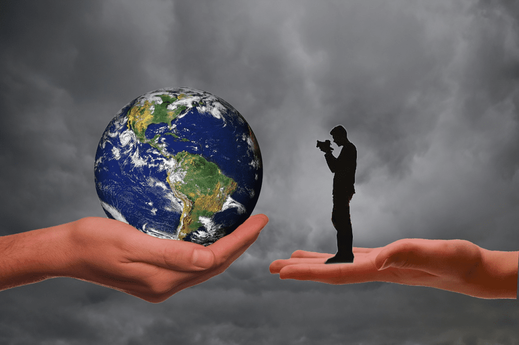
जब मैं पहली बार अंतरिक्ष में गया, तो मुझे अंतरिक्ष की काली मखमली पृष्ठभूमि पर एक सुंदर, झालरदार नीला जिम देखने की उम्मीद थी। पृथ्वी की वह छवि – बादलों के सफेद भंवरों में लिपटे एक छोटे नीले संगमरमर की असाधारण, शक्तिशाली छवि – 1970 के दशक में पर्यावरण आंदोलन का प्रतीक बन गई।

यह जीवित चीजों के लिए एक निष्क्रिय शक्ति के रूप में हमारे ग्रह की मेरी मानसिक तस्वीर थी जिसे मानव-प्रेरित क्षति और गिरावट से सुरक्षा की आवश्यकता थी। और यह बिल्कुल वैसा नहीं था जैसा मैंने देखा था। वास्तव में, मैं उस खूबसूरत और गतिशील ग्रह की पहली झलक के लिए पूरी तरह से तैयार नहीं था जिसे हम घर कहते हैं।

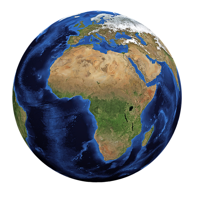
लगभग दर्दनाक रूप से चमकीली, जिस पृथ्वी को मैंने देखा, उसकी अपनी प्राकृतिक प्रक्रिया के प्रचुर सबूतों की तुलना में मानव गतिविधि के बहुत कम सबूत दिखे। जब शटल दिन का प्रकाश महासागरों के ऊपर से गुजरता है, हम महासागरों की मंथन गति को देख सकते हैं, जो पानी पर सूर्य के प्रतिबिंब में दिखाई देता है, जो पृथ्वी की सतह के 70% हिस्से को कवर करने वाले अशांत पानी में अपार ऊर्जा का प्रमाण है।

हम पृथ्वी पर सबसे ऊंची पर्वत श्रृंखला हिमालय को स्पष्ट रूप से अलग कर सकते हैं, जो भारतीय उपमहाद्वीप और एशियाई महाद्वीपों के बीच चल रहे टकराव को साबित करता है। कक्षा से, इसकी चोटियाँ झुर्रीदार, टेढ़े-मेढ़े कागज़ जैसी दिखती हैं। ज्वालामुखी पृथ्वी पर सबसे छोटे दाने के रूप में दिखाई देते हैं।

ALSO READ: LSG vs. PBKS Match 11; IPL 2024: Lucknow Batting First, Nicholas Pooran Wins Toss


कल्पना कीजिए कि पृथ्वी की नई परत के निरंतर निर्माण में होने वाली हलचल, मोड़ने, उठाने और पिघलने में कितनी ऊर्जा शामिल है! मैंने एक नाजुक ग्रह नहीं देखा, बल्कि एक जीवित, सांस लेती, शक्तिशाली पृथ्वी देखी।

का


पृथ्वी के रात्रि पक्ष ने मुझे एक अलग दृष्टिकोण दिया। रात्रि में कक्षा में प्रवेश करने पर, मानव गतिविधि के साक्ष्य प्रचुर मात्रा में स्पष्ट होते हैं। घनी आबादी वाले भूभाग या निर्मित इमारतें, जबकि आवास रेगिस्तान में विरल, लगभग पूर्ण अंधकार होता है। प्रकाश की रूपरेखा सामग्री, विशेष रूप से उत्तरी गोलार्ध में, जहां लोग समुद्र तट के किनारे रहते हैं, रोशनी की एक श्रृंखला से रोशन होती है, और कुछ स्थानों पर, राजमार्ग घनी आबादी वाले हैं, और शहर लगभग इन सभी परिवहन धमनियों के साथ विकसित हुए हैं।

इस सबने यह स्पष्ट रूप से स्पष्ट कर दिया कि जहां लोगों ने रहने के लिए चुना है वहां भूगोल और जलवायु का कितना प्रभाव है। और यह मुझे चौंकाता है कि इन उल्लेखनीय, व्यापक पुस्तकों में ग्रह के बारे में वही, भिन्न-भिन्न विचार समाहित हैं: शक्तिशाली पृथ्वी काफी हद तक अपने मानव आवासों और मानवीय गतिविधियों के साथ विकसित हो रही आकर्षक दुनिया से प्रभावित है।

मैं एक ज़ूम लेंस के माध्यम से देखने की कल्पना करता हूं, जिसकी शुरुआत पृथ्वी और ब्रह्मांड के विस्तृत क्षेत्र से होती है, और फिर पृथ्वी के निवासियों के एक माइक्रोस्कोप दृश्य पर ज़ूम करके और कैसे उन्होंने वहां की आवश्यकताओं के अनुरूप अपने परिवेश को संशोधित किया हैI

का

यह लेख ब्रह्मांड में केवल एक ग्रह के रूप में पृथ्वी का व्यापक संभव दृष्टिकोण प्रस्तुत करता है, जो हमारी प्रजातियों की पृथकता और महत्व को पुष्ट करता है। पृथ्वी पर प्रकृति के फोकस और विविधता पर अध्याय के माध्यम से प्रगति में विस्तार से विस्तार, विस्तार से विस्तार, और फिर हमारे मानव परिवार, संस्कृति और इतिहास चित्रकला की उल्लेखनीय दृश्य कहानी पर अध्याय एक संपीड़ित चित्रों की खोज करता हैI

यह राष्ट्रीय भूगोल की उत्तर पुस्तिका हमें ज्ञान के प्रति हमारी स्थायी प्यास की याद दिलाती है, जो विशिष्ट मानवीय खोज है जो हजारों वर्षों के दौरान समय और प्रौद्योगिकी में अद्भुत हलचल लेकर आई है जब हम वायुमंडल से बाहर उड़ सकते हैं, ऊपर से पृथ्वी को देख सकते हैं, और इस सुंदर को देखकर आश्चर्यचकित हो सकते हैं।

पृथ्वी पर इसकी सबसे प्रारंभिक उपस्थिति के बाद से, मानव ने अपने परिवेश को समझने की कोशिश की है। जीवित रहना ज्वालामुखी के व्यवहार, नदी के बाढ़ चक्र, या पहाड़ी दर्रे को पार करने के इष्टतम समय को समझने पर निर्भर था, और मनुष्यों ने ऐसी जानकारी को रिकॉर्ड करने और प्रसारित करने के तरीके विकसित किए। जैसे-जैसे वे अपने मूल स्थानों से जमीन और समुद्र के रास्ते आगे बढ़े, उन्होंने पृथ्वी की प्रक्रियाओं और दुनिया भर में मानव बसावट के पैटर्न और प्रभावों का व्यापक परिप्रेक्ष्य प्राप्त किया।

MORE READ: Free Satellite Imagery Sources: Zoom In Our Planet

A VIEW OF THE WORLD

A VIEW OF THE WORLD

VIEW

By Ashok Mishra

When I launched into space for the first time, I expected to see a beautiful, fringed blue gem on the black velvet background of space. That image of earth—the extraordinary, powerful image of a little blue marble wrapped in white swirls of cloud cove—became the icon of the environmental movement in the 1970s. It was my mental picture of our planet as a passive force for living things that needed protection from human-induced damage and degradation. And it was not at all what I saw. In fact, I was completely unprepared for my first glimpse of the beautiful and dynamic planet that we call home.

Almost painfully bright, the earth I saw showed little evidence of human activity when compared with abundant evidence of its own natural process. During the shuttles daylight passes over the oceans, we could see the churning motion of the oceans, visible in the sun reflection on the water, evidence of the immense energy in the turbulent water that covers 70% of the Earth surface. We could clearly distinguish The Himalaya, the highest mountain range on earth, proves the ongoing collisions between the Indian subcontinent and the Asian continents. From orbit, its peaks resemble crinkled, warping paper. Volcanoes appear as the tinniest pimples on the face of the earth.

ALSO READ: LSG vs. PBKS Match 11; IPL 2024: Lucknow Batting First, Nicholas Pooran Wins Toss


Imagine how much energy is involved in all the winkering, folding, lifting, and melting in the continuous creation of the earth’s new crust! I didn’t see a delicate planet, but rather a no nonsense, strong Earth.

VIEW


The night side of the earth gave me a different perspective. On night pass-in orbit, evidence of human activity is abundantly clear. Densely populated landmass or built-up buildings, whereas sparsely in Habitat deserts, there is almost complete darkness. Light outline content, particularly in the Northern Hemisphere, where people live along the coastline, is illuminated by a string of lights, and in some places, highways are densely populated, and cities have grown up with almost all these transportation arteries.

This made it unmistakably clear how much the geology and environment impact where individuals have decided to reside. And it strikes me that these remarkable, comprehensive books contain within them these same, divergent views of the planet: The powerful Earth is largely affected by its human habitats and the fascinating world that is growing with human activities. I imagine looking through a zoom lens, starting with a wide field of view of Earth and the universe, and then zooming in to a microscope view of Earth’s inhabitants and how they have modified their surroundings to suit there needs.

VIEW

This article presents the broadest possible view of the earth as just one planet in the universe, reinforcing the apartness and significance of our species. Spread by spread, detail by detail in progress from the view through chapter on the focus and variety of natures on earth, and then to chapter on the remarkable view story of our human family, culture, and history painting search a compressive pictures, this National Geography answer book reminds us of our sustainable thirst for knowledge that uniquely human quest that has brought as through thousands of years to the amazing movement in time and technology when we can fly out of the atmosphere, view Earth from above, and marvel at this beautiful planet.

Geography

Since there earliest presence on earth, humans have sought to make sense of their surroundings. Endurance relied upon understanding the way of behaving in a well of lava, the flood patterns of a waterway, or the ideal chance to cross a mountain pass, and people created approaches to record and pass on such information. As they ventured from their places of origin, by land and by sea, they acquired a broader perspective of the earth’s processes and of the patterns and impacts of human settlement throughout the world.

MORE READ: Free Satellite Imagery Sources: Zoom In Our Planet