Electoral Bonds: Controversy and loyalty in the world of political donations

image 27

Electoral Bonds

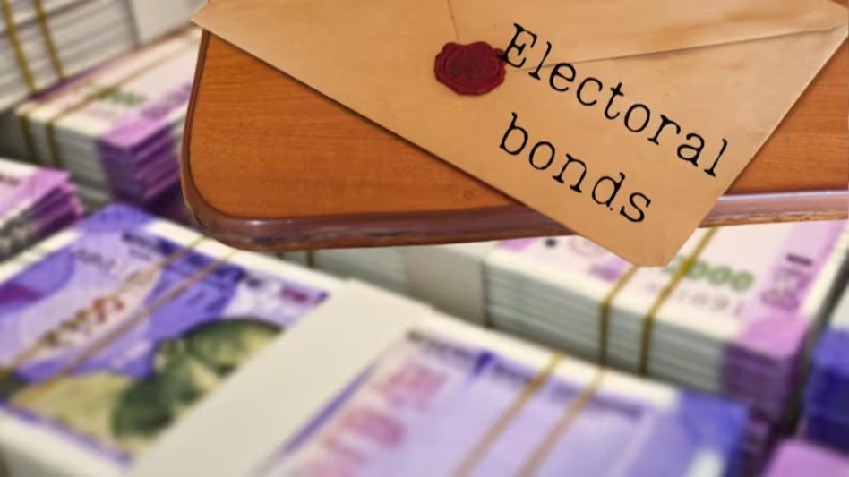
Electoral Bonds: In almost all the democracies around the world, the increasing role of money in politics and the problems related to it keep appearing in the news. Nowadays, there is discussion in India too. Every day, some or another revelation is coming out regarding electoral bonds.

If we study the figures, then it is still going on. Especially big corporations are being monitored, and it is being seen who is loyal to whom. Can we improve the silver system in the coming years?

Analysis of data released by the Election Commission of India shows that most corporations that purchase electoral bonds more than once are not loyal to any one party. The Bharatiya Janata Party has 43 loyal corporate donors, which is the highest compared to other parties.

Mamata Banerjee’s All India Trimurga gives 16 boons to Congress after BJP This analysis defines loyal donors as companies that have donated more than once and to the same party each time. Such donors include. The biggest buyer was Kolkata-based Ripley and Company and Handling Pvt Ltd, which was topped in value by the five properties given to BJP by DLF Commercial Developers worth Rs 130 crore.

91 companies that bought after the elections more than once had donated to the same party multiple times. The analysis of the election data released by the Election Commission is still going on. It is worth noting that 263 companies have challenged the analysis several times.

According to the report, out of 762 corporate donors, 263 have bought post-poll funds more than once within the stipulated time frame. Mega Engineering & Infrastructure companies buying the most frequently have bought the Chhattisgarh band and donated to nine different parties.

Electoral Bonds: BJP is the biggest beneficiary

The biggest beneficiary was the BJP, which was donated by 362 different corporate donors, out of which 43 were loyal donors, followed by 177 donors to the Congress, but only eight donors donated repeatedly.

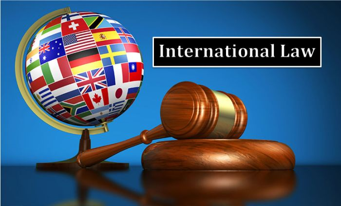
ALSO READ: International Law: Definition and Concept

The big party as well as the ruling party also benefited in the matter of electoral bonds. Currently, BJP is the only party in our country with more than 300 donors, followed by Congress and Trinamool. These four major parties alone have more than 100 corporate donors. Corporates give life to those parties.

The policy of these companies can be easily explained to those who are in power, however, the very nature of donations made by corporations remains in dispute and the parties who receive donations remain on target.

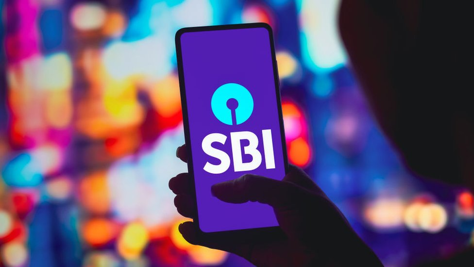
We are able to see that the State Bank of India, the Supreme Court, and the Election Commission have tried to ensure transparency by issuing the final, but the political party has not given anything in this direction from the Supreme; in fact, there is no political party in our country. The party is not like that and can claim to have completely white money in its coffers.

Is political donation (Electoral Bonds) transparent in America, the oldest democracy?

The United States has learned from its experience, however, that even there, donations are not completely transparent. If you donate more than $50 directly to a candidate’s campaign, the campaign must report identifying data and secrets to the Federal Election Commission.

The problem lies in how non-profit organizations can spend money without disclosing donors. The US estimated that spent money in the 2020 election was more than a billion dollars.

Electoral Bonds

Most of the world’s democracies are affected by political donations (Electoral Bonds)

Money is needed for politics, and in most countries, it impacts the election funding system. For example, in the recruitment scam in Japan, the Sensation’s Waste Mister scam in the UK, and the famous Water Gate scam in America, there are always a series of scams related to election payments. Recall that the problem of finances is worrying in almost all democracies. Election-based political corruption has also affected many European democracies, like Italy, Greece, France, Spain, and Belgium.

Companies also choose (electoral bond) parties as per their choice

It is worth noting that, according to the electoral data so far, 11 companies have changed parties. After donating to one party once, 11 companies have decided to donate to another party next time.

One of these companies is Aurobindo. There is also pharma, which is being discussed a lot. In these 11 cases, five friends have been the beneficiaries. Anmol Congress has been the beneficiary. The BJP has benefited in only three cases. No company wants to spoil its relations with any branch; hence, it donates to more parties.

Electoral Bonds

What happens in America (Electoral Bonds)?

America may be the oldest democracy in the world, but it is also the most expensive democracy in the world. If you want to contest the presidential or congressional elections in America, then be prepared to become the best fundraiser. Accordingly, there should be an account audit and a legal team. In America, every transaction is closely monitored, and under the established system, people keep getting necessary information related to funding.

In any democracy, only Sita’s answer to the question of political funding will lead to many freedoms. A balance is also needed between principles and relatively equal opportunity, particularly as the US judiciary has learned from its history and understanding to handle political finance while maintaining constitutional guarantees of participation in the political process.

MORE READ: Electoral Bonds: Controversy and loyalty in the world of political donations

अंतर्राष्ट्रीय कानून की परिभाषा और अवधारणा

image 20
अंतर्राष्ट्रीय कानून

अंतर्राष्ट्रीय कानून: अंतर्राष्ट्रीय विधि को आरंभ में राष्ट्रोंकी विधि कहा जाता था के किंतु राष्ट्रों के आपसी संबंधों को विनियमित करने वाले नियमों को राष्ट्रों की विधि कहना भ्रामक लगता था क्योंकि इस शब्द से ऐसा आभास होता था कि कई राष्ट्रों की विधि का अध्ययन किया जाता है इसी कारण सर्वप्रथम बेंथम ने सन 1789 में इस शब्द के स्थान परअंतर्राष्ट्रीय विधि शब्द का प्रयोग किया और तभी से यह नाम प्रचलित है

अंतर्राष्ट्रीय कानून: अधिकांश परंपरागत न्यायाधीशों ने अंतर्राष्ट्रीय विधि को एक ऐसी विधि के रूप में माना है जो राष्ट्रों की पारस्परिक संबंधों को विनियमित करती है और इसी अर्थ में इसको परिभाषित भी करती है ओपनहाइम के अनुसार राष्ट्रों की विधि या अंतर्राष्ट्रीय विधि उन रूढ़िजन्य ने तथा संधीबद्ध नियमों के समूह कानाम है जिन्हें राज्यों द्वारा पारस्परिक संबंधों में वेद रूप से बाध्यकारी माना जाता है

अंतर्राष्ट्रीय कानून: इस परिभाषा में महत्वपूर्ण तत्व निहित है प्रथम अंतर्राष्ट्रीय विधि राज्यों के मध्य संबंधों को शासित करने वाले नियमों के समूह से संबंधित है संबंधों शब्द काअभिप्राय ऐसे संबंधों से है जो राष्ट्रों द्वारा अपने विदेशी कार्यायलयों या विदेशी मामलों की विभागों के मध्य में बनाए जाते हैंअंतर्राष्ट्रीय विधि के नियम राज्यों की लगभग सभी क्रियाकलापों को शासित करता है इसके नियम समुद्र के उपयोगबाहरी अंतरिक्ष तथा अल्टरनेटिका को शासित करते हैं तथा अंतरराष्ट्रीय संवाद वहां डाक सेवाएं और अंतरराष्ट्रीय वायु यातायात से संबंधित नियम भी शासित होते हैंI

ALSO READ: मानचित्रण का इतिहास

अंतर्राष्ट्रीय कानून: अंतर्राष्ट्रीय विधि के नियम राष्ट्रीयता अनुदेशीय प्रत्यर्पण मानव अधिकार पर्यावरण की संरक्षण से भी संबंधित है यह कहना अनुचित न होगा कि राज्यों की मध्य की शायद ही कोई ऐसी गतिविधि होगी जो अंतर्राष्ट्रीय विधि से शासित ना होगीयह राज्यों द्वारा इन पारस्परिक संबंधों की नियमों को अपने ऊपर बाधिकारी माना जाता है अंतर्राष्ट्रीय विधि के नियम राज्यों के ऊपर वेद रूप से लागू होते हैं ना कि केवल नैतिकता के आधार परजब इराक ने कुवैत पर 1990 में आक्रमण किया या संयुक्त राज्य अमेरिका ने इस इराक पर 2003 में आक्रमण किया तब विश्व के अधिकतर राज्य ने ऐसी कृतियों को अनैतिक ना कह कर अवैध कहा तृतीय ऐसे नियम वीडियो और संधियों से बने हैंI

अंतर्राष्ट्रीय कानून

ओपेनहेम की नई परिभाषा

अंतर्राष्ट्रीय कानून: ओपनहइम अंतर्राष्ट्रीय विधि की उपयुक्त परिभाषा 1955 में प्रकाशित पुस्तक इंटरनेशनल लॉ के आठवीं संस्करण में दी थी इसके पश्चात अंतर्राष्ट्रीय विधि में मूलभूत परिवर्तन हुए जिसके कारण उपयुक्त परिभाषा आधुनिक अंतरराष्ट्रीय विधि के संदर्भ में असंगत हो गईऔर उसे संकीर्ण मन जाने लगा यह परिभाषा आधुनिक अंतरराष्ट्रीय विधि पर समुचित रूप से लागू नहीं होती I

अंतर्राष्ट्रीय कानून: इसी कारण करअर्बन ट्रेनिंग और सर अर्थ द्वारा संपादित ओपनहइम की 1992 में प्रकाशित पुस्तक इंटरनेशनल लॉ की नवी संस्करण मेंअंतर्राष्ट्रीय विधि की उपयुक्त परिभाषाकी कमियों को दूर करते हुए नई परिभाषा दी गई नियमों का वह समूह है जो राज्यों के पारस्परिक संबंधों में उन पर अवधकर है यह नियम प्राथमिक रूप से वे नियम है जो राज्यों के संबंध को शासित करते हैं किंतु केवल राज्योंकी अंतर्राष्ट्रीय विधि के विषय में नहीं अंतरराष्ट्रीय संगठन तथा कुछ हद तक व्यक्त भी अंतर्राष्ट्रीय विधि द्वारा प्रदकअधिकारों तथा अधिरोपित कर्तव्य के विषय हो सकते हैं

अंतर्राष्ट्रीय कानून: यह परिभाषा इस अर्थ में पहले वाली परिभाषा से अधिक व्यापक हैं क्योंकि यह अंतरराष्ट्रीय संगठनों तथा व्यक्तियों को भी अपने में सम्मिलित करती है जो अंतर्राष्ट्रीय विधि के नियमों द्वारा शासित होते हैं फिर भी इस परिभाषा की आलोचना इस आधार पर की जा सकती है कि ओपन है ने अपनी परिभाषा में अंतरराष्ट्रीय संगठनों तथा व्यक्तियों को अंतर्राष्ट्रीय विधि का विषय माना लेकिन ये नहीं कहा है कि अंतर्राष्ट्रीय विधि के नियम अंतरराष्ट्रीय संगठनों तथा व्यक्तियों पर आबंध हैं इस कारण ओपन है कि अंतर्राष्ट्रीय विधि की नई परिभाषा भी समुचित रूप से आधुनिक अंतरराष्ट्रीय विधि के रूप में अनुरूप नहीं है

अंतर्राष्ट्रीय कानून: स्टार्क की अंतर्राष्ट्रीय विधि की परिभाषा इस क्षेत्र में ओपन हम की परिवर्तित परिभाषा की तरह ही व्यापक है उनके अनुसार अंतर्राष्ट्रीय विधि व समूह है जिसका अधिकांश भाग आचरण के उन सिद्धांतों तथा नियमों से बना है जिनका अनुपालन करने के लिए राज्य अपने को मध्य अनुभव करते हैं अतः वे अपने पारस्परिक संबंधों में इसका समानता अनुपालन करते हैं तथा इसमें यह भी सम्मिलित है कि-

अंतर्राष्ट्रीय कानून

1-अंतरराष्ट्रीय संस्थाओं या संगठनों की कार्य प्रणाली और उनके पारस्परिक संबंध तथा राज्य एवं युवतियों के संबंधों की वैधानिक नियमI

2-कुछ वैधानिक नियम जो व्यक्तियों तथा गैर राज्य इकाइयों के अधिकारों तथा कर्तव्यों के संबंध में अंतरराष्ट्रीय मुद्दों से संबंधित हैंI

अंतर्राष्ट्रीय विधि की उत्तर परिभाषा परंपरागत परिभाषाओं से भिन्न है जहां परंपरागत परिभाषाएं केवल राज्यों को अपनी सीमा में रखती है वहीं स्टार्क ने उनके क्षेत्र को विस्तार करते हुए कहा है कि अंतर्राष्ट्रीय विधि राज्यों के साथ अंतरराष्ट्रीय संस्थाओं या संगठनों व्यक्तियों तथा अन्य गैर्य राज्य इकाइयों के अधिकारों तथा कर्तव्यों को भी विनियमित करती हैं यह इकाइयां अंतर्राष्ट्रीय विधि के क्षेत्र में अंतर्गत विकास केफलस्वरूप आई हैं|

जो वर्तमान शताब्दी के आरंभ में विशेष कर संयुक्त राष्ट्र संघ के बनने के बाद हुए हैं किंतु स्टार्क इसको स्वीकार करते हैं कि प्राथमिक रूप सेयह राज्यों के पारस्परिक अधिकारों तथा कर्तव्यों को ही वनी नियमित करती है सही अर्थ में स्टार्क ने अपनी परिभाषा में विभिन्न इकाइयों के नाम का उल्लेख किया हैI

जिनके अधिकार तथा कर्तव्य अंतर्राष्ट्रीय विधि के नियमों द्वारा विनियमित किया जाने लगते हैं किंतु ऐसी कोई इकाई जो स्टॉक द्वारा उल्लेखित नहीं है यदि समय के अंतराल के साथ अंतर्राष्ट्रीय विधि के अंतर्गत आ जाती हैतथा यदि उनके अधिकारों तथा कर्तव्यों के अंतर्राष्ट्रीय विधि के वी नियमों द्वारा विनियमित किया जाने लगता है तो परिभाषा पुनः आलोचना का विषय बन जाएगी इस प्रकार यह परिभाषा आने वाले सभी विषयों के लिए उपयुक्त नहीं हो सकती है भविष्य में जब कोई नई इकाई अंतरराष्ट्रीय व्यक्तित्व को अर्जित करेगी तथा वह परिभाषा संकीर्ण हो जाएगीI

MORE READ: अंतर्राष्ट्रीय कानून की प्रकृति और विकास

International Law: Definition and Concept

image 19
International Law

International law was initially called the law of nations, but it seemed misleading to call the rules regulating the mutual relations of nations. This law is called the law of nations because this term gives the impression that the law of many nations was studied. That is why, in the first place, Bentham used the word international law in place of this word in 1789, and since then this name has been prevalent.

Most traditional judges have considered international law to be a law that regulates the mutual relations of states and also defines it in this sense. According to Oppenheim, the law of states is the set of rules and regulations made by those people. Stereotypes are laws that are considered legally binding by states in their mutual relations.

ALSO READ: THE MAPPING HISTORY

An important element lies in this definition. First, this law is related to the set of rules governing relations between states. The term relations refers to the relations that are maintained by the states between their foreign offices or departments of foreign affairs.

The rules govern almost all the activities of states. Its rules govern the use of the ocean, outer space, and international communication. There are also rules governing postal services and international air traffic. Rules of this law, nationality, extradition, human rights, and the environment. It is also related to protection. It would not be unfair to say that there would hardly be any activity between states that would not be governed by international law.

International Law

The states consider the rules of these mutual relations as their authority. The rules of this law are binding on the states. They are applied strictly and not just on the basis of morality. When Iraq invaded Kuwait in 1990 or the United States invaded Iraq in 2003, most of the states in the world called such acts illegal rather than immoral. Third, such rules are made from videos and treaties.

New Definition Of Oppenheim

Oppenheim had given the appropriate definition of this law in the eighth edition of the book International Law, published in 1955. After this, there were fundamental changes in international law, due to which the appropriate definition became inconsistent with the context of modern international law and started being considered narrow-minded.

That is why it is not implemented properly. In the new edition of Oppenheim’s book International Law, published in 1992 and edited by Urban Training and Sir Arth, a new definition has been given to overcome the shortcomings of the appropriate definition of international law. It is a set of rules that govern the mutual relations of states. These rules are primarily those that govern the relations of states, but not only the international law of states; they may also be the subject of international organizations and, to some extent, express rights and duties imposed by this law.

This definition is broader than the previous one in the sense that it also includes international organizations and individuals who are governed by the rules of this law, yet this definition can be criticized on the basis that it is open In its definition, it has considered international organizations and individuals as the subject of international law but has not said that the rules of this law are binding on international organizations and individuals; hence, it is open that the new definition of this law can also be appropriately considered as modern international law. doesn’t fit in.

Stark’s definition of this law is as broad as Open Hum’s modified definition in this area. According to him, international law is a set of principles and rules of conduct that states feel themselves bound to follow. Therefore, they follow it equally in their mutual relations, and this also includes:

International Law

1. The functioning of international institutions or organizations, their mutual relations, and the legal rules of relations between the state and women.

2. Maintain legal rules that relate to international issues regarding the rights and duties of individuals and non-state entities.

Answer: The definition of international law is different from the traditional definitions, where traditional definitions keep only the states within their limits, whereas Stark has expanded their scope and said that international law deals with the rights of international institutions or organizations, individuals and other non-state entities along with states.

These units have come about as a result of developments in the field of international law that have taken place at the beginning of the present century, especially after the formation of the United Nations, but Stark accepts that they primarily deal with the mutual rights of states.

In the true sense, Stark has mentioned the names of various units in his definition whose rights and duties come to be regulated by the rules of international law, but any such unit that is not mentioned by stock will, with time, come under international law, and if their rights and duties start to be regulated by the rules of international law, then the definition will again become a subject of criticism. Thus, this definition may not be suitable for all the subjects. In the future, when a new entity acquires international personality and that definition becomes narrower.

MORE READ: The nature and development of international law

मानचित्रण का इतिहास

image 16
मानचित्रण

मानचित्रण का इतिहास: मेरी रचनाओं में से एक गीत – रेत में मौसम की लिखावट, टेढ़े-मेढ़े पत्थर पर माप, या गीतों और कला में डरा हुआ भूगोल – सभी संस्कृतियों में आम है। सबसे पुराने जीवित मानचित्र और चार्ट प्राचीन बेबीलोनिया और मिस्र से प्राप्त होते हैं। तीसरी सहस्राब्दी ईसा पूर्व तक, दोनों के पास आवश्यक गणितीय और प्रारूपण कौशल थे, और नौकरशाही बेबीलोनियन कार्टोग्राफी के सर्वेक्षण और मानचित्रण के लिए जिम्मेदार थी, जो ज्यादातर आंशिक थी, जबकि मिस्र के मानचित्रों में पौराणिक भूमि और जीवन के बाद के मार्गों का मानचित्रण किया गया था।

मानचित्रण का इतिहास:: यूनानियों ने पृथ्वी और ब्रह्मांड की प्रकृति की जांच करते हुए पश्चिमी मानचित्रकला की वैज्ञानिक नींव रखी। रोमनों ने अधिकतर संपत्तियों, नगर योजनाओं और सड़कों का मानचित्रण किया। साथ ही, चीनियों ने अपने मानचित्रों में कला और मौखिक कथा को शामिल किया, फिर भी वे सैन्य योजना और राज्य सुरक्षा को लेकर भी चिंतित थे। जापान और कोरिया भी अपने विश्व मानचित्रों के लिए चीन पर निर्भर थे और उन्होंने स्वयं को हाशिये पर डाल लिया।

Read also: ब्रह्माण्ड भाग-2

मानचित्रण का इतिहास: मध्य युग में धार्मिक मानचित्रकला का बोलबाला था। हालाँकि अरबों ने शास्त्रीय बौद्धिक परंपरा को बनाए रखा और अपनी इस्लामी मानचित्र-निर्माण परंपरा भी विकसित की।

मानचित्रण का इतिहास: प्रिंटिंग प्रेस के आविष्कार और भूगोल के लिए टॉलेमी की मार्गदर्शिका की पुनः खोज ने पश्चिमी यूरोप में वैज्ञानिक मानचित्रकला में पुनरुद्धार को बढ़ावा दिया, जो कि स्पेनिश और पुर्तगालियों द्वारा अफ्रीका, अमेरिका और स्पाइस द्वीपों की यात्राओं से तेज हुआ। फ्रांसीसी आधिकारिक भूमि सर्वेक्षण करने वाले पहले व्यक्ति बने, जिन्होंने 1787 तक 182 मानचित्र शीट तैयार कीं। ब्रिटिशों ने 19वीं शताब्दी की शुरुआत में भारत के महान त्रिकोणमितीय सर्वेक्षण का निर्माण करने के लिए फ्रांसीसी तकनीक को अपनाया।

मानचित्रण

ऑर्टेलियस और मर्केटर, अग्रणी मानचित्र निर्माता

मानचित्रण का इतिहास: एक युवा फ्लेमिश विद्वान और भूगोलवेत्ता के रूप में, अब्राहम ऑर्टेलियस (1527-1588) को मानचित्र पांडुलिपियों को कुशलतापूर्वक प्रकाशित करने और पुस्तकों और सिक्कों के संग्रह के लिए जाना जाता था। एक बार कार्डियोग्राफर के रूप में स्थापित होने के बाद, उन्होंने 1570 में थियेट्रम ऑर्बिसटेरारम, या थिएटर ऑफ़ द वर्ल्ड के प्रकाशन के साथ पुनर्जागरण की दुनिया में क्रांति ला दी। इसे प्रथम मॉडल एटलस के रूप में जाना जाता है।

थिएट्रम एक बड़ी सफलता साबित हुई और उसने यूरोपीय मानचित्र व्यापार के केंद्र को रोम और वेनिस से एंटवर, उसके घर में स्थानांतरित करने में मदद की। जब वह वहां है, और आप उसका घर हैं। 31 संस्करण और 7 भाषाओं में लगभग 7,300 प्रतियां मुद्रित की गईं और आज लगभग 1,630 डॉलर के बराबर कीमत पर बेची गईं, जिससे ऑर्टेलियस बहुत अमीर हो गया।

थिएटरम में ऑर्टेलियस मित्र और साथी फ्लेमिश कार्डियोग्राफर, जेरार्डस मर्केटर, 1512-1594 द्वारा तैयार विश्व प्रक्षेपण की एक पृष्ठ की कमी शामिल है। पहली बार 1569 में प्रकाशित, मर्केटर प्रोजेक्शन को नेविगेशन जोड़ने के लिए डिज़ाइन किया गया था। अक्षांश और देशांतर में सभी रेखाओं को सीधी रेखाओं के रूप में दर्शाए जाने से, नाविक अधिक आसानी से लंबी दूरी तक अपना रास्ता बना सकते हैं।

मानचित्रण

मानचित्रण का इतिहास: अपने मूल समुद्री उद्देश्य के बावजूद, मेरेटर प्रक्षेपण, संशोधन के साथ, 20वीं शताब्दी तक दुनिया का एक मानक द्वि-आयामी प्रतिनिधित्व बन गया। स्कूली बच्चों की पीढ़ियों ने मर्केटर प्रोजेक्शन का अध्ययन किया है, जिससे उन्हें विश्वास हो गया कि ग्रीनलैंड और अफ्रीका लगभग एक ही आकार के हैं, हालांकि वे वास्तव में 14 गुना बड़े हैं।

आधुनिक मानचित्र

मानचित्रण का इतिहास: सर्वेक्षण और मानचित्रण की वैज्ञानिक विधियों का 17वीं, 18वीं और 19वीं शताब्दी में काफी विस्तार हुआ, आंशिक रूप से अधिक परिष्कृत गणितीय अनुप्रयोगों के साथ-साथ बड़े क्षेत्रों के कठोर और व्यापक सर्वेक्षणों के कारण।

आज सर्वेक्षण में अक्सर रिमोट सेंसिंग के तत्वों का उपयोग किया जाता है – दूर से किसी वस्तु या क्षेत्र के बारे में जानकारी प्राप्त करना। किसी ऊंची इमारत की चोटी से किसी शहर को या ऊंचे पहाड़ की चोटी से किसी गांव को देखना रिमोट सेंसिंग का एक रूप है। मानचित्र निर्माता समान परिणाम प्राप्त करने के लिए अधिक परिष्कृत तरीकों का उपयोग करते हैं।

एरियल फोटोग्राफी, जिसका उपयोग कुछ हद तक प्रथम विश्व युद्ध के दौरान किया गया था, द्वितीय विश्व युद्ध के दौरान मानचित्र-निर्माण में रिमोट सेंसिंग उपकरण के रूप में व्यापक हो गई। इसने सर्वेक्षकों की अधिकांश कठिनाइयों को समाप्त कर दिया और कुछ अन्य दुर्गम स्थानों को सटीक सर्वेक्षण आवंटित कर दिया।

रडार, या रेडियो तरंगों और सोनार, या ध्वनि तरंगों द्वारा रिमोट सेंसिंग, समुद्र तल पर भूमि की सतह की विशेषताओं को रिकॉर्ड करने का एक और तरीका प्रदान करता है। दोनों तरीकों में, दूरी की गणना लक्ष्य क्षेत्र तक पहुंचने में लगने वाले समय से की जाती है। दूर से संवेदित छवियां उनके द्वारा दर्शाए गए रिज़ॉल्यूशन के प्रकार के आधार पर भिन्न होती हैं।

स्थानिक रिज़ॉल्यूशन से तात्पर्य यह है कि कोई छवि कितनी तेज़ है। अधिक दूरी को आमतौर पर धुंधली छवियों के बराबर माना जाता है।

स्पेक्ट्रल रिज़ॉल्यूशन से तात्पर्य है कि प्रकाश स्पेक्ट्रम के किस हिस्से को कैप्चर किया जा रहा है और इसमें दृश्य प्रकाश या अवरक्त प्रकाश जैसी तरंग दैर्ध्य शामिल हो सकते हैं।

अस्थायी समाधान प्रतिनिधित्व की गई समय सीमा को संदर्भित करते हैं। यह तकनीक समय के साथ परिवर्तन दिखाने के लिए किसी क्षेत्र की अनुक्रमिक छवियों का उपयोग करती है।

Read more: ब्रह्माण्ड

THE MAPPING HISTORY

image 14
MAP

Song from one of my makings—weather scribbles in sand, measurement on a chiseled stone, or scared geography in songs and art—is common to all cultures. The earliest surviving map and charts come from ancient Babylonia and Egypt. By the third Millennium B.C., both possessed the necessary mathematical and drafting skills, and the bureaucracy was responsible for the surveying and mapping of the Babylonian cartography, which was mostly partial, whereas Egyptian maps mapped mythical land and routes to afterlife

The Greeks laid the scientific foundation of Western cartography while investigating the nature of the Earth and the universe. The Romans mostly mapped properties, town plans, and roads. At the same time, the Chinese incorporated art and verbal narrative into their maps, yet they were also concerned with military planning and state security. Japan and Korea also relied on China for their world maps, adding themselves to the fringes.

Read also: THE UNIVERSE, PART-2

Religious cartography held sway in the middle Ages. Although Arabs maintained classical intellectual traditions and developed their own Islamic map-making traditions as well,.

The invention of the printing press and the rediscovery of Ptolemy’s guide to geography sparked a revival in scientific cartography in western Europe, asseverated by voyages by the Spanish and Portuguese to Africa, America, and the Spice Islands. The French became the first to conduct an official land survey, producing 182 map sheets by 1787. The British adopted French technique to produce the Great Trigonometric Survey of India in the early 19th century.

MAP

ORTELIUS & MERCATOR, PIONEERING MAPMAKERS

As a young Flemish scholar and geographer, Abraham Ortelius (1527–1588) was known for skillfully illuminating map manuscripts and for his collection of books and coins. Once established as a cardiographer, he revolutionized the Renaissance world with the publication in 1570 of Theatrum Orbis Terrarum, or Theater of the World. It is known as the first model atlas.

The Theatrum proved a huge success and helped transfer the center of the European map trade from Rome and Venice to Antwer, his home. when is there, and you are his home. Some 7,300 copies were printed in 31 editions and 7 languages and sold at a cost equivalent to about 1,630 dollars today, making Ortelius very wealthy.

The Theatrum include a one-page reduction of the world projection drawn by the Ortelius friend and fellow Flemish cardiographer, Gerardus Mercator, 1512–1594. First published in 1569, the Mercator projection was designed to add navigation. With all lines in latitude and longitude depicted as straight lines, mariners could more easily plot a course over a long distance.

MAP

Despite its original nautical purpose, the Merator projection, with modification, became a standard two-dimensional representation of the world until well into the 20th century. Ages of schoolchildren have concentrated on Mercator projection, which persuaded them to think that Greenland and Africa were generally a similar size, in spite of the fact that they are, as a matter of fact, multiple times bigger.

Modern Maps

Scientific methods of surveying and mapping expanded greatly in the 17th, 18th, and 19th centuries, in part due to more sophisticated mathematical applications as well as rigorous and comprehensive surveys of large areas.

Surveying today often employs elements of remote sensing-obtaining information about an object or an area from a distance. Peering down on a city from the highest point of a tall structure or on a town from the highest point of a tall mountain is a type of remote detection. Map maker’s use more sophisticated methods to get similar results.

Ariel photography, used to some extent during World War 1, became widespread during World War 2 as a remote sensing tool in map-making. It eliminated much of the legwork for surveyors and allotted precise surveying to some other inaccessible places.

Remote sensing by radar, or radio waves, and Sonar, or sound waves, provides another way to record surface features of the land on the ocean floor. In both methods, distance is calculated from the time it takes to reach the target area. Remotely detected pictures fluctuate by the sort of goal they depict.

Spatial resolution refers to how sharp an image is. Greater distance is usually equated with fuzzier images.

Spectral resolution refers to which part of the light spectrum is being captured and can include such wavelengths as visible light or infrared light.

Temporal resolutions refer to the time frame represented. The technique uses sequential images of an area to show changes over a period of time.

Read more: History of Mapping

ब्रह्माण्ड भाग-2

image 10
ब्रह्माण्ड

ब्रह्माण्ड कम से कम 99.99% खाली स्थान है। इस विशाल, अंधेरे शून्य में तैरते हुए। वहाँ सभी प्रकार की विभिन्न वस्तुएँ हैं, जिन्हें खगोलशास्त्री खगोलीय पिंड कहते हैं; इनमें धूल के कणों से लेकर ग्रह, तारे और आकाशगंगाएँ तक शामिल हैं। हमारे सौर मंडल में एक तारा, सूर्य और ग्रहों और चंद्रमाओं का एक बड़ा परिवार शामिल है जो उसी गैस के बादल से बने हैं जिसने सूर्य को जन्म दिया था। हाल के वर्षों में, सैकड़ों अन्य तारों के आसपास ग्रह देखे गए हैं, जिससे पता चलता है कि हमारा सौर मंडल हमारी आकाशगंगा में अरबों में से एक हो सकता है।

ब्रह्माण्ड: क्षुद्र ग्रह

सौर मंडल के निर्माण से बचे चट्टानी पिंडों को क्षुद्रग्रह कहा जाता है। इनका आकार बोल्डर से लेकर बौने ग्रह के आकार के करीब के पिंडों तक होता है।

ब्रह्माण्ड: कोमेट

ये सौरमंडल के बाहरी हिस्से से आए बर्फ के टुकड़े हैं। कुछ लोग जैसे-जैसे सूर्य के निकट आते हैं और उससे गर्म होते हैं, गैस और धूल की लंबी पूँछें विकसित हो जाती हैं।

ब्रह्माण्ड: चंद्रमा

चंद्रमा, जिसे प्राकृतिक उपग्रह भी कहा जाता है, एक पिंड है जो किसी ग्रह की परिक्रमा करता है। पृथ्वी के पास केवल एक चंद्रमा है, लेकिन बृहस्पति ग्रह के पास लो सहित 67 चंद्रमा हैं।

ब्रह्माण्ड: बौना गृह

द्वार ग्रह स्टेरॉयड से बड़े लेकिन ग्रहों से छोटे होते हैं। ग्रहों की तरह इनका आकार भी गोल है। प्लूटो को बौने ग्रह के रूप में जाना जाता है।

ALSO READ: विश्व भूगोल

ब्रह्माण्ड: ग्रह

यह एक बड़ी और लगभग गोलाकार वस्तु है जो एक तारे की परिक्रमा करती है और अपने कक्षीय पथ से मलबे को हटा देती है। सौर मंडल में 8 ग्रह हैं।

ब्रह्माण्ड: सितारे

गैसों के ये चमकदार गोले, जैसे सूर्य, अपनी परमाणु ऊर्जा उत्पन्न करके चमकते हैं, और तारे विभिन्न प्रकार, तापमान और आकार में आते हैं।

ब्रह्माण्ड: नाब्युला

अंतरिक्ष में गैस और धूल के चमकते बादल को निहारिका कहा जाता है। कुछ निहारिकाएँ मरते तारों द्वारा निर्मित मलबे के बादल हैं; दूसरे नये सितारों को जन्म देते हैं।

ब्रह्माण्ड

समय में पीछे मुड़कर देखना

क्योंकि प्रकाश को यात्रा करने में समय लगता है, जब हम अंतरिक्ष में देखते हैं, तो हम समय में पीछे देख रहे होते हैं। दिखाई देने वाली सबसे दूर की वस्तुएँ हबल टेलीस्कोप द्वारा खींची गई आकाशगंगाएँ हैं। हमने उन्हें वैसे ही देखा जैसे वे 30 अरब साल पहले थे। ब्रह्माण्ड इनसे कहीं आगे तक फैला हुआ है, लेकिन इससे अधिक दूर तक वस्तुओं को देखना असंभव है क्योंकि उनके प्रकाश को उन तक पहुँचने का समय नहीं मिला है।

सबसे दूर की वस्तुएँ

हबल टेलीस्कोप से ली गई इस तस्वीर में सबसे कमजोर आकाशगंगाओं की रोशनी को पृथ्वी तक पहुंचने में 3 अरब साल लग गए।

क्या बात है ?

ब्रह्मांड में हम जो पदार्थ देख सकते हैं उनमें से 98 प्रतिशत तत्व हाइड्रोजन और हीलियम हैं। लेकिन जिस तरह से तारे और आकाशगंगाएँ गुरुत्वाकर्षण द्वारा खींचे जाते हैं, उसका हिसाब लगाने के लिए पर्याप्त सामग्री नहीं लगती है। परिणामस्वरूप, खगोलविदों का मानना है कि आकाशगंगाओं में काला पदार्थ होता है, जिसे हम देख नहीं सकते। ब्रह्माण्ड का विस्तार करने वाली एक अज्ञात शक्ति भी है, जिसे डार्क एनर्जी के नाम से जाना जाता है।

क्या कोई वहां है?

विज्ञान में सबसे बड़े प्रश्नों में से एक यह है कि क्या जीवन पृथ्वी पर अद्वितीय है या अन्य दुनिया में उत्पन्न हुआ है। और यदि जीवन कहीं और प्रकट हुआ है, तो क्या बुद्धिमान प्राणी विकसित हो सकते हैं? वैज्ञानिकों ने अलौकिक प्राणियों के संकेतों को देखने और सुनने के लिए एक परियोजना स्थापित की है, और हमारे अस्तित्व के बारे में किसी भी एलियंस को सूचित करने के लिए सितारों को संदेश भेजे गए हैं।

अरेसिबो संदेश

1974 में, वैज्ञानिकों ने स्टार क्लस्टर M13 की ओर एक रेडियो संदेश प्रसारित करने के लिए प्यूर्टो रिको में विशाल अरेसीबो रेडियो टेलीस्कोप का उपयोग किया। संदेश में प्रतीक (दाएं) शामिल है जो मानव का प्रतिनिधित्व करता है, हमारी आधार-10 गिनती प्रणाली, डीएनए अणु और सौर मंडल एलियंस को शामिल करने के गंभीर प्रयास की तुलना में एक प्रचार स्टंट है, प्रसारण को एम 13 तक पहुंचने में 25,000 साल लगेंगे, और एक जवाब आने में 25,000 साल लगेंगे.

ब्रह्माण्ड

पायनियर पट्टिका

रोबोटिक अंतरिक्ष यान पायनियर 10 और पायनियर 11 ने 1973-74 में बृहस्पति और शनि ग्रह का दौरा किया और फिर गहरे अंतरिक्ष में उड़ान भरी। यदि एलियंस कभी भी अंतरतारकीय अंतरिक्ष के माध्यम से बहते हुए एक यान की खोज करते हैं, तो उन्हें पृथ्वी से एक संदेश के साथ उत्कीर्ण एक स्वर्ण-ग्रह पट्टिका मिलेगी।

सेटी

सेटी (परलौकिक बुद्धि की खोज) परियोजना में शामिल खगोलविदों ने विदेशी सभ्यताओं द्वारा प्रसारित कृत्रिम रेडियो संकेतों की खोज में आकाश को स्कैन करने के लिए शक्तिशाली रेडियो दूरबीनों का उपयोग किया। SETI परियोजना 1960 से चल रही है, लेकिन कुछ झूठी चेतावनियों के बावजूद, इसे अब तक विदेशी संकेतों का कोई निर्णायक सबूत नहीं मिला है।

MORE READ: Geography

THE UNIVERSE PART-2

image 8
THE UNIVERSE

The universe is at least 99.99% empty space. Floating in this vast, dark void. There are all sorts of different objects, which astronomers call celestial bodies; they range from grains of dust to planets, stars, and galaxies. Our planetary group incorporates a star, the sun, and an enormous group of planets and moons that are framed by the very haze of gas that brought forth the sun. In recent years, Planets have been seen around hundreds of other stars, showing that our solar system maybe one of billions in our galaxy.

Asteroids

Rocky lumps left over from the formation of the solar system are called asteroids. They range in size from stones to bodies near the size of a bantam planet.

Read also: THE WORLD GEOGRAPHY

Comet

These are chunks of ice from the outer reaches of the solar system. Some develop long tails of gas and residue as they approach the sun and are warmed by it.

Moon

A moon, also called a natural satellite, is a body that orbits a planet. Earth has only one moon, but the planet Jupiter has 67, including Lo.

Dwarf Planet

Dwar planets are larger than steroids but smaller than planets. Like planets, they are round in shape. Pluto is best known as a dwarf planet.

Planet

It is a large and nearly spherical object that orbits a star and has swept its orbital path clear of debris. The solar system has 8 planets.

Stars

These brilliant bundles of gases, for example, the sun, sparkle by producing their own atomic power, and stars arrive in many kinds, temperatures, and sizes.

Nebula

A glowing cloud of gas and dust in space is known as a nebula. Some nebulae are clouds of wreckage created by dying stars; others give birth to new stars.

THE UNIVERSE

THE UNIVERSE: Because light takes time to travel, when we look into space, we are looking back in time. the most distant objects visible are galaxies photographed by the Hubble Telescope. We saw them as they were 30 billion years ago. The universe extends far beyond these, but it is impossible to see objects much further because their light has not had time to reach them.

Furthest Objects

The light from the faintest galaxies in this photo from the Hubble Telescope took 3 billion years to reach Earth.

What is the matter?

THE UNIVERSE: The elements hydrogen and helium make up 98 percent of the matter we can see in the universe. But there does not seem to be enough matter to account for the way stars and galaxies are pulled by gravity. As a result, astronomers think galaxies contain dark matter, which we cannot see. There is likewise an obscure power that makes the universe extend, known as dull energy.

Is there anyone out there?

One of the biggest questions in science is whether life is unique to Earth or has arisen in other worlds. And if life has appeared elsewhere, could intelligent beings have evolved? Scientists have set up a project to watch and listen for signals from extraterrestrials, and messages have been sent to the stars to inform any aliens out there of our existence.

ARECIBO MESSAGE

THE UNIVERSE: In 1974, scientists used the giant Arecibo Radio Telescope in Puerto Rico to broadcast a radio message towards the star cluster M13. The message contains a symbol (right) to represent human beings, our base-10 counting system, DNA molecules, and the solar system. This is more of a publicity stunt than a serious attempt to contain aliens; the broadcast will take 25,000 years to reach M13, and a reply will take 25,000 years to return.

THE UNIVERSE

PIONEER PLAQUE

The robotic spacecraft pioneers 10 and 11 visited the planets Jupiter and Saturn in 1973–74 and then flew off into deep space. If aliens ever discover a craft drifting through interstellar space, they will find a gold-planet plaque engraved with a message from Earth.

SETI

Astronomers involved in the Seti (search for extraterrestrial intelligence) project used powerful radio telescopes to scan the skies in search of artificial radio signals broadcast by alien civilizations. The SETI project has been running starting around 1960, however it has up to this point tracked down no convincing proof of outsider signs, regardless of a few misleading problems.

Read more: Welcome to the Universe

विश्व भूगोल

image 4
विश्व

विश्व भूगोल: मिस्र, फोनीशियन और चीनी भौगोलिक समझ जैसी प्राचीन संस्कृतियाँ, लेकिन उनमें से कुछ ही अभिलेख बचे हैं, और इसलिए यूनानी आज के प्रारंभिक ज्ञान का मुख्य स्रोत बन गए हैं। होमर के महाकाव्य, द लियाड और द ओडिसी, नौवीं शताब्दी ईसा पूर्व में वापस आते हैं। वे यूनानियों को दुभाषियों, यात्रियों और दूर देशों के पर्यवेक्षकों के रूप में प्रकट करते हैं। वे वैज्ञानिक जांच में भी उत्कृष्ट थे।

15वीं, 16वीं और 17वीं शताब्दी में यूरोपीय और एशियाई दोनों खोजकर्ताओं द्वारा अन्वेषण के उत्कर्ष के दौरान भूभौतिकी ज्ञान तेजी से उन्नत हुआ। प्रत्येक यात्रा में मानचित्रण, सर्वेक्षण और मसाला एकत्र करना स्टॉक गतिविधियाँ बन गईं।

Read also: ब्रह्मांड

21वीं सदी में, कुछ कंप्यूटर क्लिक से पृथ्वी की सतह के अधिकांश भाग की तस्वीरें या मानचित्र संबंधी जानकारी प्राप्त की जा सकती है। हम मानचित्र पर मार्ग दर्शाने की आवश्यकता के बिना, लगभग कहीं भी जाने के लिए दिशा-निर्देश प्राप्त करने की क्षमता को मान लेते हैं।

आधुनिक विज्ञान और सूचना संग्रहण ने भूगोलवेत्ताओं को पहले से कहीं अधिक अंतर्दृष्टि प्रदान की है, और आधुनिक तकनीक इसे दुनिया भर में साझा करने की अनुमति देती है, लेकिन कई लोगों के लिए, तथ्यों और शब्दों में संदर्भ का अभाव है। भूगोल की समझ, भौतिक और सांस्कृतिक दोनों, उस संदर्भ को और अधिक आवश्यक और महत्वपूर्ण बनाती है। वैश्विक बातचीत और पृथ्वी के भविष्य के लिए जिम्मेदारी साझा करना हम सभी को जोड़ता है।

विश्व

टॉलेमी/प्राचीन भूगोलवेत्ता

ग्रीक वंश के मिस्र में जन्मे क्लॉडियस टॉलेमी (लगभग 90-168 ई.) ने कार्टोग्राफी, गणित और खगोल विज्ञान के ग्रीक-रोमन विश्व ज्ञान को संश्लेषित करने वाले कार्य का एक समूह बनाया। उनके आठवें खंड, भूगोल, ने विश्व मानचित्र और 26 क्षेत्रीय मानचित्रों सहित एक शब्द मानचित्र तैयार करने के लिए निर्देश और जानकारी प्रदान की।

उन्होंने कई मानचित्र प्रक्षेपण भी खोजे और लगभग 8,000 स्थानों के नाम और उनके निर्देशांक की एक सूची प्रदान की। अल्मागेस्ट, सौर मंडल के खगोल-भौगोलिक मॉडल पर उनका 13-खंड का ग्रंथ, और उनकी चार पुस्तकें ट्रट्राबिब्लोस ने ज्योतिष को अधिक वैज्ञानिक मामले के साथ समेटने की कोशिश की, जो इस्लामी विद्वानों द्वारा किए गए अरबी अनुवादों के माध्यम से फैला और पूर्वी और पश्चिमी भूगोल और कार्टोग्राफी विचारों को प्रभावित किया।

भूगोल का दायरा

आज विश्व भूगोल स्थान में निहित है, लेकिन इसमें मानचित्र पर स्थान के नामों की स्थिति से कहीं अधिक शामिल है; यह कई अलग-अलग विषयों के तरीकों और ज्ञान को एकीकृत करता है, और आय भौतिक और सामाजिक विज्ञान दोनों से होकर गुजरती है। यह निर्धारित करने के लिए इन सभी विषयों का उपयोग करता है। चीज़ें किसी विशेष स्थान पर या विशेष स्थानिक पैटर्न के अनुसार क्यों घटित होती हैं?

कॉर्पोरेट भूविज्ञान और जलवायु विज्ञान, जीव विज्ञान, पारिस्थितिकी, जल विज्ञान और अन्य प्राकृतिक विज्ञानों में भौतिक भूगोल। मानव विश्व भूगोल में समाजशास्त्र, अर्थशास्त्र, राजनीति विज्ञान, इतिहास, जनसांख्यिकी और अन्य सामाजिक विज्ञान शामिल हैं। कार्टोग्राफी, जो मानचित्र बनाने की कला और विज्ञान है, भौगोलिक सेटिंग्स का ग्राफिक प्रतिनिधित्व प्रदान करती है।

विश्व भूगोलवेत्ता अपने डेटा एकत्रीकरण, विश्लेषण और प्रतिनिधित्व में अन्य उपकरणों का भी उपयोग करते हैं, जिनमें सांख्यिकीय तस्वीरें, दूर से खींची गई छवियां जैसे उपग्रह तस्वीरें और कंप्यूटर-जनित ग्राफिक्स शामिल हैं।

विश्व

मानचित्रों में विश्व

सोचिए कि एक संतरे को छीलना और उसके छिलके के टुकड़ों को मेज पर दबाकर रखना कितना कठिन है। यह सादृश्य मानचित्र निर्माता के सामने आने वाली चुनौती का प्रतिनिधित्व करता है, जो गोलाकार ग्रह पृथ्वी को एक सपाट दृश्य प्रतिनिधित्व में बदलने का प्रयास करता है। किसी गोले की सतह को जीवंत बनाने की चुनौती से निपटने के लिए, सपाट मानचित्रकार उन आकृतियों का उपयोग करते हैं जो खुद को समतल करने में सक्षम होती हैं, जैसे योजनाएं और सिलेंडर जिन्हें विकास योग्य सतहों के रूप में जाना जाता है।

विकास योग्य सतहों पर गणितीय गणना लागू करके, वे पृथ्वी की विशेषताओं को सपाट रूपों में बदल सकते हैं। उन रूपों को प्रक्षेपण कहा जाता है और वे मानचित्र-निर्माण की चुनौती का प्रतिनिधित्व करते हैं।

सदियों से, प्रक्षेपण अनिवार्य रूप से होते रहे हैं और परिणामस्वरूप विकृतियाँ होती हैं। मानचित्र आकार की पसंद से उन विकृतियों को कुछ हद तक नियंत्रित किया जा सकता है, जो इस बात पर निर्भर करता है कि मानचित्रकार के माध्यम से ग्रह का कौन सा हिस्सा सबसे अधिक रुचि रखता है।

केवल वहीं मानचित्र पूरी तरह से सटीक होगा जहां सतह सीधे ग्लोब को छूती है। संपर्क के इन बिंदुओं से दूर, पृथ्वी की विशेषताएं सपाट होने के लिए खिंची हुई या सिकुड़ी हुई हो जाती हैं।

Read more: Geography

THE WORLD GEOGRAPHY

image 1
WORLD

Ancient cultures such as the Egyptian, Phoenician, and Chinese geographical understanding, but few of those records survive, and so the Greeks have become today’s main source of early knowledge. Homers epics, The Liad and the Odyssey, return in the ninth century BC. They reveal the Greeks as interpreters, travelers, and observers of distant lands. They also excelled in scientific inquiry.

Geophysics knowledge advanced exponentially during the heyday of exploration by both European and Asian explorers in the 15th, 16th, and 17th centuries. Mapping, surveying, and spice collecting became stock activities on every voyage.

Read also: ब्रह्मांड

In the 21st century, a few computer clicks can bring photos or map information to much of the earth’s surface. We take for granted the ability to get directions to almost anywhere we need to go, without needing to plot the course on a map.

Modern science and information gathering have given geographers more insight then ever before, and modern technology allows it to be shared world-wide, but for many people, facts and terms lack context. An understanding of geography, both physical and cultural, makes that context ever more necessary and important. Global interactions and sharing responsibility for the earth’s future connect us all.

WORLD

Ptolemy / ANCIENT GEOGRAPHER

Born in Egypt of a Greek family, Claudius Ptolemy (ca. A.D. 90–168) created a body of work synthesizing the Greco-Roman world knowledge of cartography, mathematics, and astronomy. His eighth volume, Geography, offered instructions and information for preparing a word map, including a world map and 26 regional maps. He also found a number of map projections and provided a list of some 8,000 place names and their coordinates. Almagest, his 13-volume treatise on the astronomy-geocentric model of the solar system, and his four books, Tetrabiblos, tried to Reconcile astrology with more scientific matter Spread through Arabic translations made by Islamic scholars and influenced near eastern and western geography and cartography thoughts for centuries.

THE SCOPE OF GEOGRAPHY

Today, the world is rooted in location, but it involves more than just the position of place names on a map; it integrates methods and knowledge from many different disciplines, and income passes through both the physical and social sciences. It uses all these disciplines to determine why things occur in a specific area or as per specific spatial examples?.

Physical geography in corporate geology and climatology, biology, ecology, hydrology, and other natural sciences. Human geography includes sociology, economics, political science, history, demography, and other social sciences. Cartography, which is the art and science of making maps, provides graphic representations of geographic settings.

The World Geographers also use other tools in their data gathering, analysis, and representation, including statistical photographs, remotely captured images such as satellite photos, and computer-generated graphics.

WORLD

THE WORLD IN MAPS

Think of how hard it is to peel an orange and press the resulting pieces of peel down flat on a table. That analogy represents the challenge faced by the map maker, who attempt to turn the spherical planet earth into a flat visual representation. To handle the test of getting the outer layer of a circle to life, level map makers use shapes that lend themselves to straightening, for example, plans and chambers known as developable surfaces.

By applying numerical estimations to the developable surfaces, they can change earth highlights into level structures. Those forms are called projections and represent the challenge of map-making.

Through the centuries, projections have inevitably resulted in distortions. Those distortions can be controlled to some degree by the choice of map shape, which depends on which part of the planet is of most interest to the cartographer.

Only where the surface directly touches the globe will the map be completely accurate. Away from these points of contact, earthen features become stretched or squeezed in order to become flat.

Read more: Geography

ब्रह्मांड

image 8

ब्रह्मांड

ब्रह्मांड

ब्रह्मांड अस्तित्व का छिद्र है – संपूर्ण स्थान, पदार्थ, ऊर्जा और समय। ब्रह्मांड को इतना देखा जाता है कि यह अकल्पनीय है, लेकिन हम जानते हैं कि 13.8 अरब साल पहले बिग बैंग नामक एक विस्फोटक घटना के साथ इसकी शुरुआत के बाद इसका विस्तार हो रहा है।

लोग ब्रह्मांड को एक विशाल क्षेत्र के रूप में सोचते थे, लेकिन अब हम जानते हैं कि चीजें इतनी सरल नहीं हैं। ब्रह्माण्ड का संभवतः कोई केंद्र या बाहरी किनारा नहीं है; इसका केवल एक अंश ही हमें दिखाई देता है। अवलोकनीय ब्रह्माण्ड इससे कहीं अधिक बड़ा हो सकता है, संभवतः अनन्त गुना। एक सघन ब्रह्मांड अपने आप को एक बंद आकार में मोड़ लेगा। एक सीधी रेखा में यात्रा करने से आप अपने शुरुआती बिंदु पर वापस आ जाएंगे।

Read also: विश्व का एक दृश्य

अंतरिक्ष का आकार

ब्रह्मांड में पदार्थ से गुरुत्वाकर्षण बल के कारण अंतरिक्ष के तीन आयाम एक चौथे आयाम में मुड़ जाते हैं जिसे हम नहीं देख सकते हैं। इसकी कल्पना करना कठिन है, इसलिए वैज्ञानिक इस विचार को समझाने के लिए द्वि-आयामी रबर शीट के रूपक का उपयोग करते हैं। ब्रह्माण्ड का द्रव्यमान इस रबर शीट को तीन तरीकों में से एक में मोड़ सकता है, यह इस बात पर निर्भर करता है कि ब्रह्माण्ड पदार्थ से कितना सघन रूप से भरा हुआ है।

अधिकांश वैज्ञानिक अब सोचते हैं कि ब्रह्मांड का आकार चपटा है। यदि ब्रह्मांड पर्याप्त घना नहीं है, तो यह एक खुले आकार में फैल सकता है, जिससे इसका आकार अनंत हो जाएगा और इसका कोई बाहरी किनारा नहीं होगा। पदार्थ की सही मात्रा ही ब्रह्मांड को एक सपाट आकार देगी। इसका आकार भी अनंत होगा, जिसका कोई बाहरी किनारा नहीं होगा।

ब्रह्मांड

ब्रह्मांड इतना विशाल है कि हम बड़े पैमाने पर छलांग लगाए बिना इसके आकार की सराहना नहीं कर सकते। चित्रों की इस शृंखला में, प्रत्येक चरण अपने दाहिनी ओर की छवि के एक सूक्ष्म कण का प्रतिनिधित्व करता है। अंतरिक्ष में विशाल दूरियों से निपटते समय, किलोमीटर पर्याप्त बड़े नहीं होते हैं। इसके बजाय, खगोलशास्त्री प्रकाश की गति को एक मापदण्ड के रूप में उपयोग करते हैं। प्रकाश इतना तेज़ है कि यह एक सेकंड में पृथ्वी के चारों ओर 7.5 बार चक्कर लगा सकता है। एक प्रकाश वर्ष वह दूरी है जो प्रकाश एक वर्ष में तय करता है – लगभग 10 ट्रिलियन किमी या 6 ट्रिलियन मील।

पृथ्वी और चंद्रमा

पृथ्वी 12,756 किमी या 7,926 मील चौड़ी है। अंतरिक्ष में हमारा निकटतम पड़ोसी चंद्रमा है, जो 384,400 किमी या 238,855 मील की दूरी पर पृथ्वी की परिक्रमा करता है। यदि पृथ्वी एक फुटबॉल के आकार की होती, तो चंद्रमा लगभग 21 मीटर या 69 फीट दूर एक तरबूज के आकार का होता।

सौर परिवार

8 ग्रहों का सूर्य परिवार 9 अरब किमी या 5.6 अरब मील चौड़े क्षेत्र पर कब्जा करता है। यदि पृथ्वी एक फुटबॉल होती, तो सौर मंडल के इस हिस्से में चलने में 5 दिन लगते, और निकटतम तारा 58 साल की पैदल दूरी पर होता।

तारकीय पड़ोस

सूर्य से निकटतम तारा प्रॉक्सिमा सेंटॉरी है, जो केवल 4 से 4 प्रकाश वर्ष दूर है। सूर्य से 50 प्रकाश वर्ष के भीतर लगभग 2000 तारे हैं; ये हमारे तारकीय पड़ोस का निर्माण करते हैं, जो आकाशगंगा का एक छोटा सा अंश है।

ब्रह्मांड

मिल्की वे आकाश गंगा

मिल्की वे आकाशगंगा 200 अरब तारों का एक विशाल बादल है। इसका आकार एक सपाट डिस्क से घिरे केंद्रीय उभार के साथ एक के पीछे एक रखे हुए गौरव अंडों की जोड़ी जैसा दिखता है। यह डिस्क के पार 1 लाख प्रकाश वर्ष और उभार के माध्यम से 2000 प्रकाश वर्ष गहराई मापता है।

आकाशगंगाओं का स्थानीय समूह

आकाशगंगा अवलोकनीय ब्रह्मांड में संभवतः 7 ट्रिलियन आकाशगंगाओं में से एक है जो समूहों में मौजूद हैं जिन्हें क्लस्टर कहा जाता है। गुरुत्वाकर्षण के कारण, आकाशगंगा एक क्लस्टर का हिस्सा है जिसे स्थानीय समूह के रूप में जाना जाता है, जो लगभग 10 मिलियन प्रकाश वर्ष चौड़ा है।

सुपर क्लस्टर

आकाशगंगा के समूह और भी बड़े समूह में मौजूद हैं जिन्हें सुपर क्लस्टर कहा जाता है। हम कन्या सुपर क्लस्टर में रहते हैं, जो गैर-ब्रह्मांड के लाखों सुपर क्लस्टर में से एक है। इनके बीच विशाल खाली क्षेत्र हैं जिन्हें ब्रह्मांडीय शून्यता कहा जाता है।

ब्रह्मांड

ऐसा माना जाता है कि सुपरक्लस्टर फिलामेंट का एक विशाल जाल बनाते हैं जो विशाल रिक्तियों से भरा होता है जिसमें कोई आकाशगंगा नहीं होती है। ब्रह्माण्ड का वास्तविक आकार एक रहस्य है और इसका केवल एक अंश ही हमें दिखाई देता है। ब्रह्मांड आकार में अनंत भी हो सकता है।

Read more: Read more: What is the universe?